
S.H.I.E.L.D — Shellfish Habitats for Integrated EcoLogical Defence — is a project funded under PUB’s Coastal Protection and Flood Resilience Research Programme (CFRP) Living Lab initiative, led by the Centre for Climate Adaptation at SUTD. It begins with a simple question: what if a coastline could be grown rather than poured?
Much of Singapore's shore is protected by hard structures — seawalls and revetments that hold the line, but may offer limited ecological value and opportunities for people to interact with the coast. As seas rise and storms strengthen, the coast needs defences that do more than resist.
S.H.I.E.L.D imagines a different kind of edge: a reef that softens the force of the waves, thickens and strengthens as it ages, shelters the life of the intertidal zone, and invites people back to the water. A piece of infrastructure that is also a habitat, and also a place.
Precedent
The project builds on earlier pilot work in Singapore by Witteveen+Bos, which placed artificial oyster reefs on the jetty piles of a small marina — a heavily human-influenced shoreline — where increased species richness and shellfish recruitment were observed. S.H.I.E.L.D carries that knowledge further — joining shellfish habitat with mineral accretion, and growing it into a reef shaped for tropical waters.
The need is growing. Around a third of Singapore lies less than five metres above mean sea level. Average sea levels could rise by up to 1.15 metres by the end of the century — and as high as four to five metres when extreme high tides meet storm surges. Stronger, more energetic waves could place greater pressure on vulnerable stretches of shoreline, including areas affected by coastal erosion, in a dense city with little room to retreat.
Yet the coast is not only ours to protect. Today around 65% of Singapore's shoreline is made up of seawalls (Tan et al., 2023). Along its edges a hidden world persists — oysters, snails, crabs, corals and seagrass, quietly overlooked by the grey defences built to hold the line. S.H.I.E.L.D imagines a reef that could help reduce wave energy reaching the shoreline, while giving marine life somewhere to settle, feed and grow: a defence that works with the sea rather than against it.
The Reef System
Singapore University of Technology and Design (SUTD)
In collaboration with: Mlion Corporation | Witteveen+Bos South-East Asia | HSL Constructor
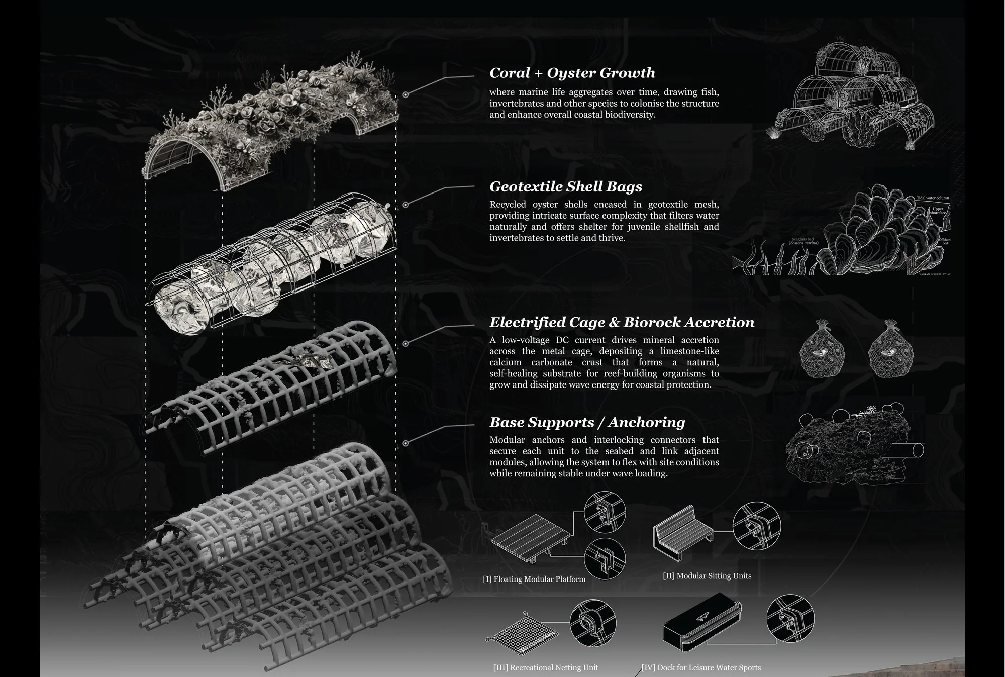
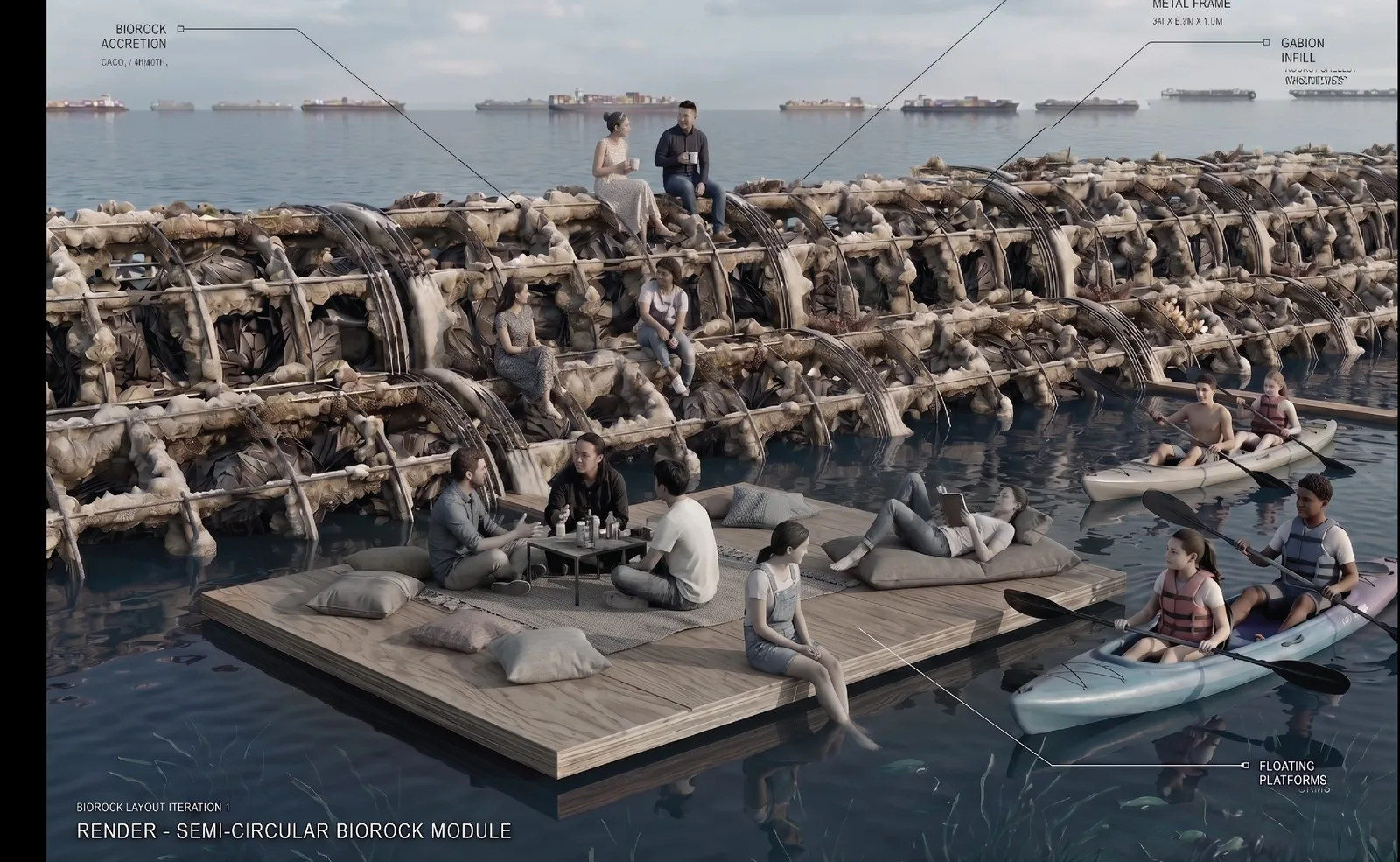
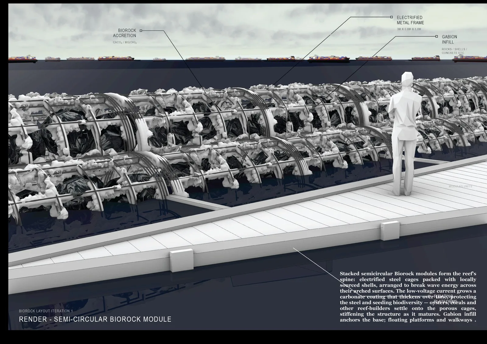
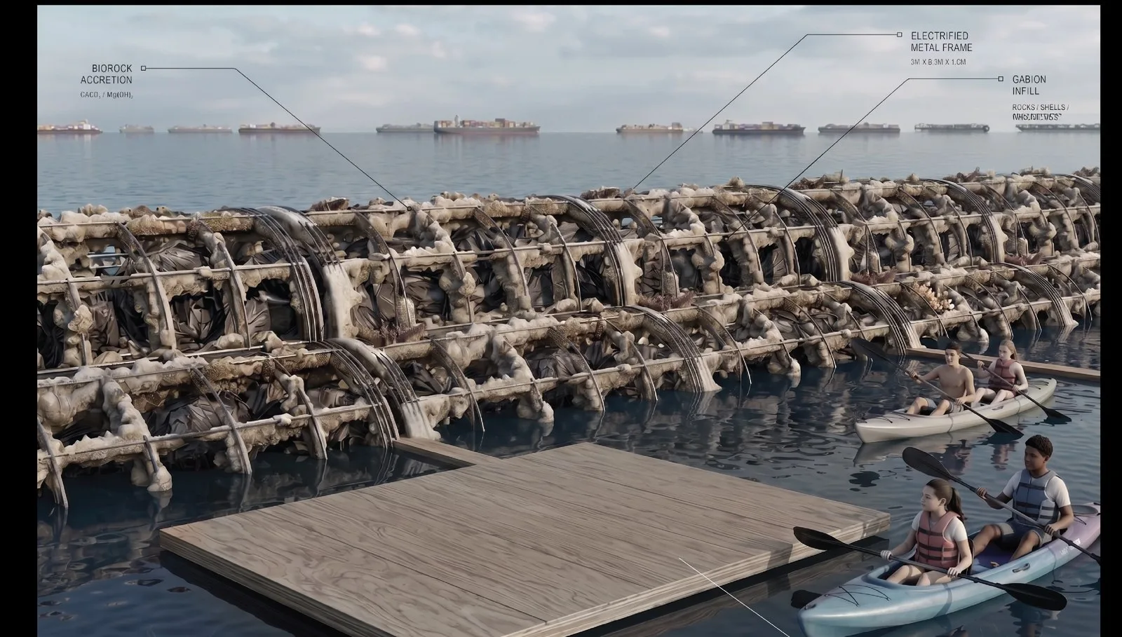
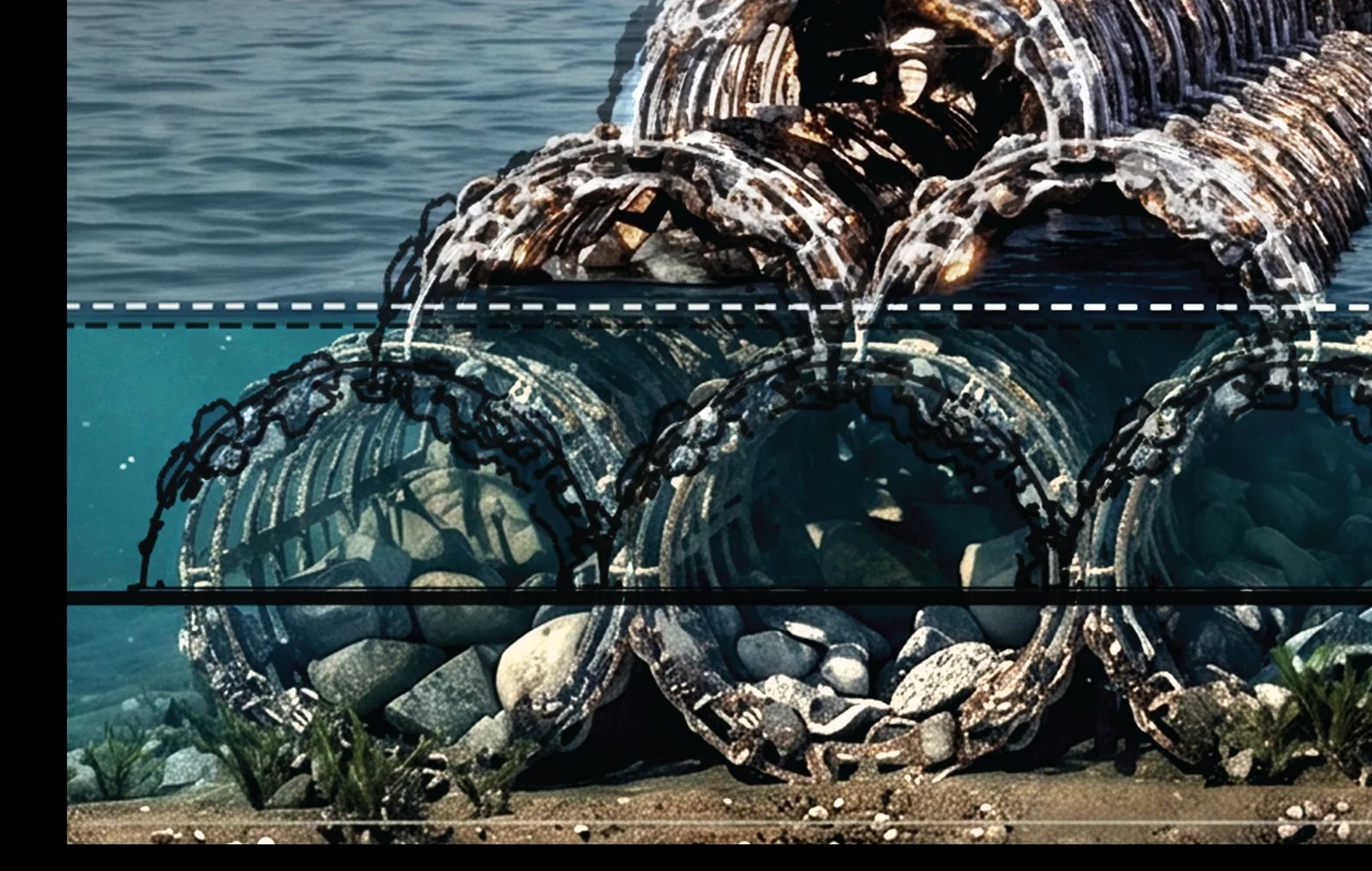
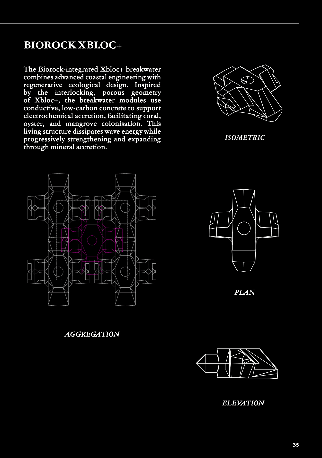
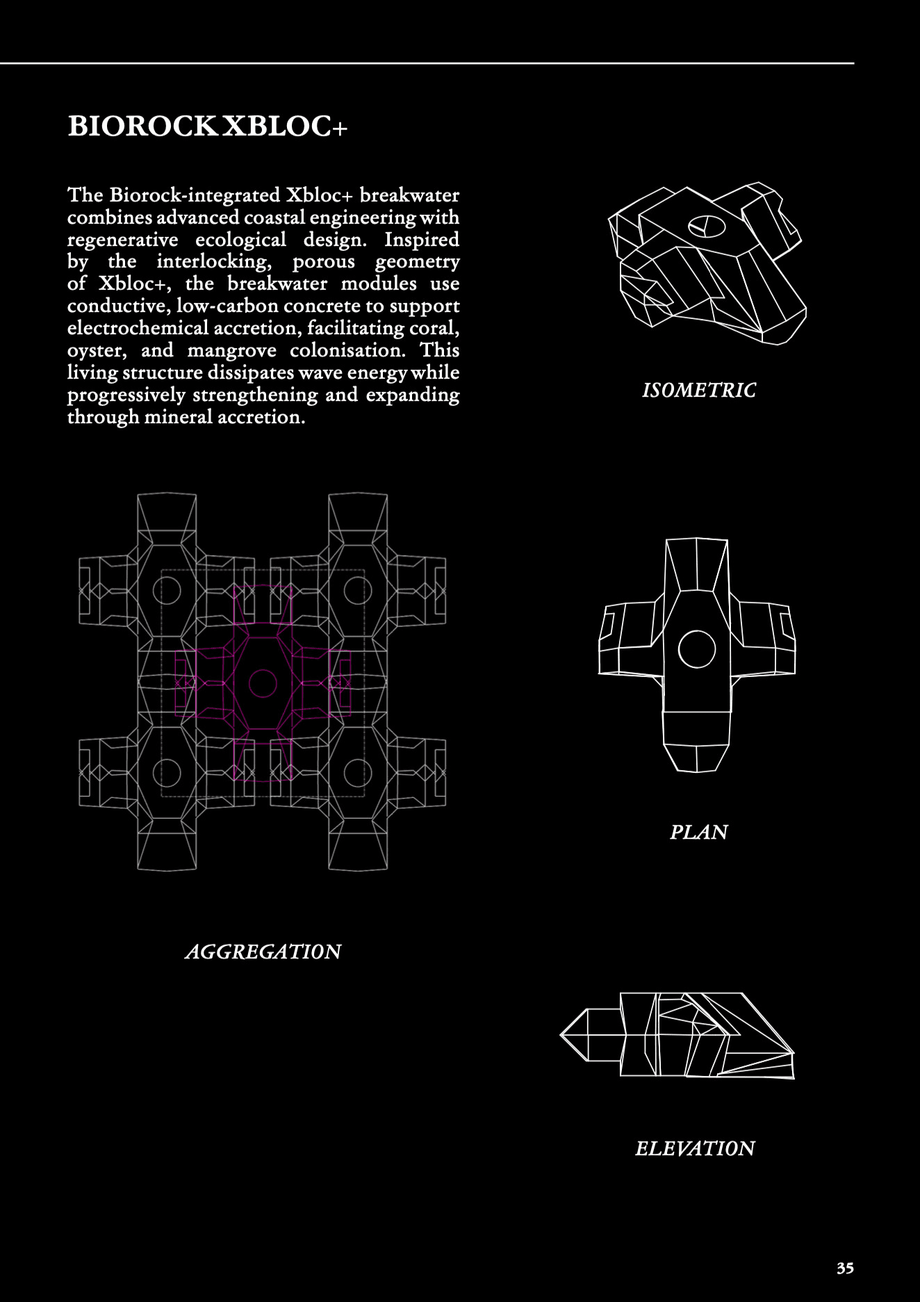
The reef is built from what the city throws away. Oyster, mussel and cockle shells from local restaurants are gathered into biodegradable mesh and packed into modular steel cages. Over time, marine life cements the shells together and the mesh quietly dissolves, leaving a structure that is held together by growth.
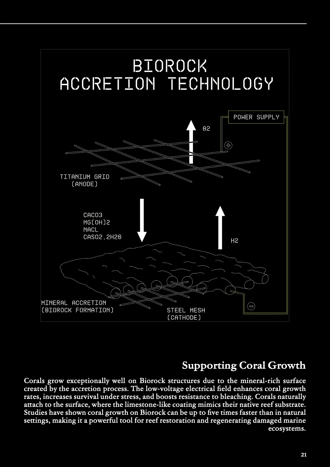
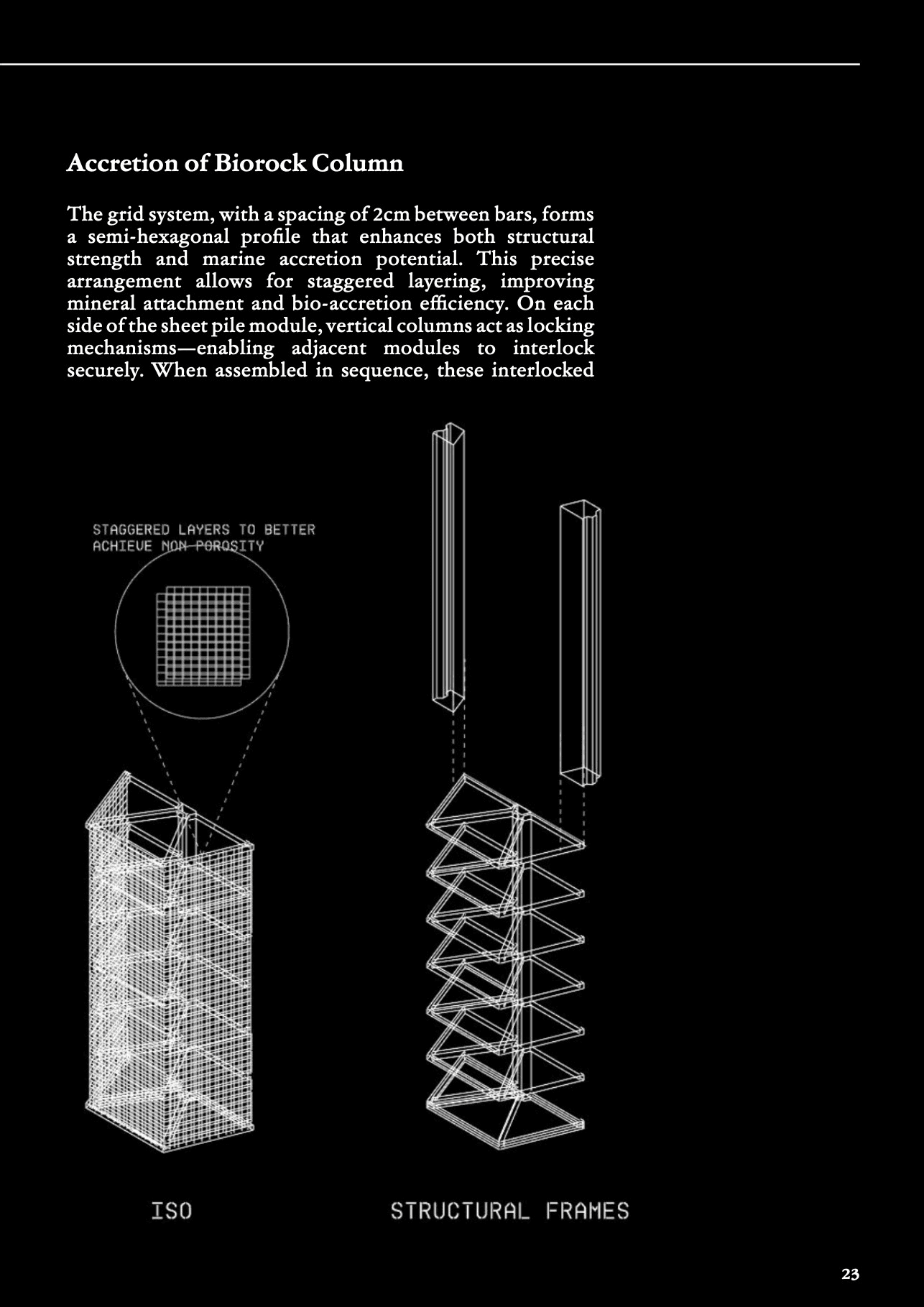
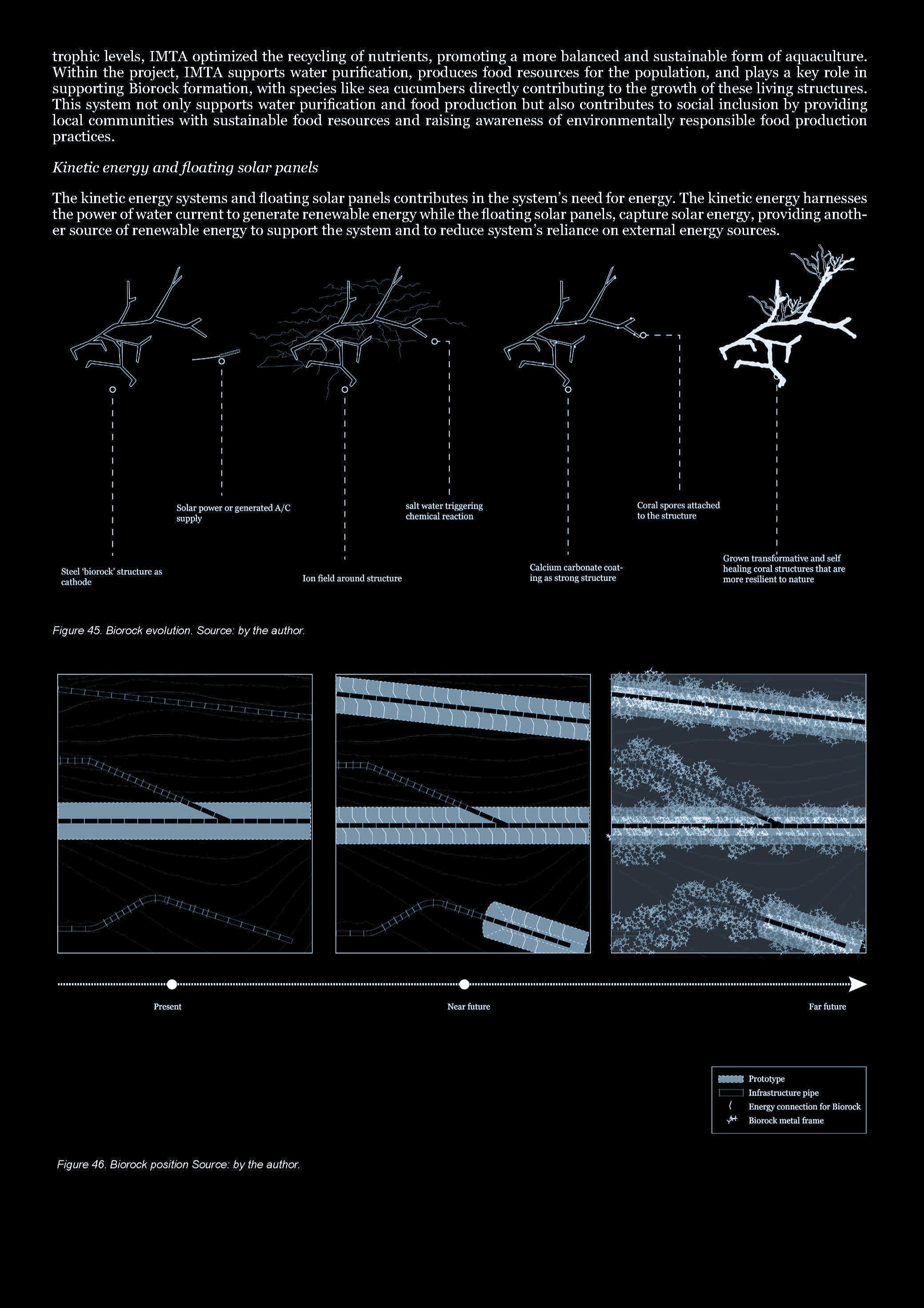
A gentle electric current runs through the steel — a technique known as Biorock. It draws minerals out of the seawater and wraps the frame in a living limestone skin that protects it from corrosion, strengthens it year after year, and quickens the arrival of corals, oysters and the creatures that follow them.
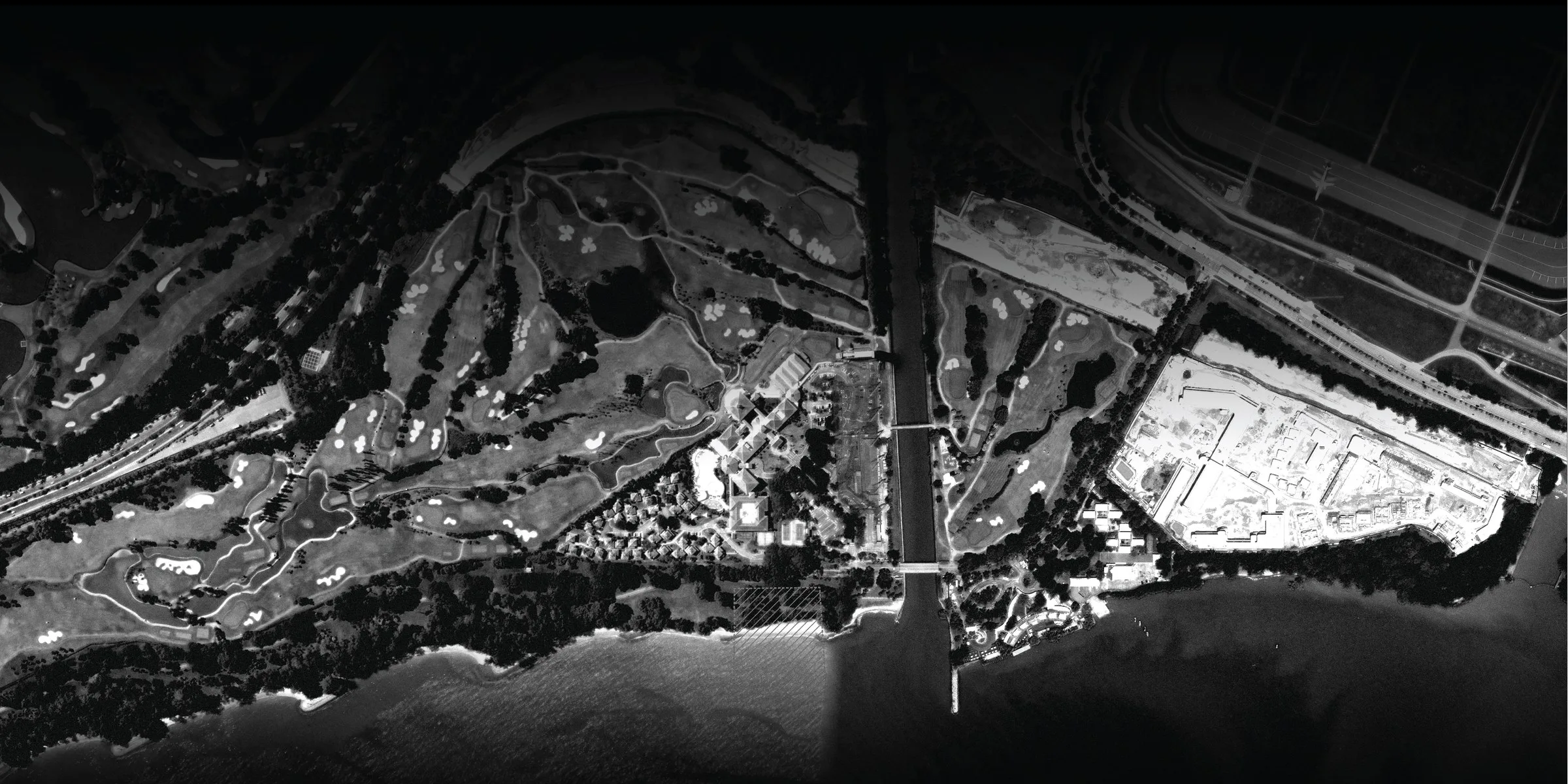
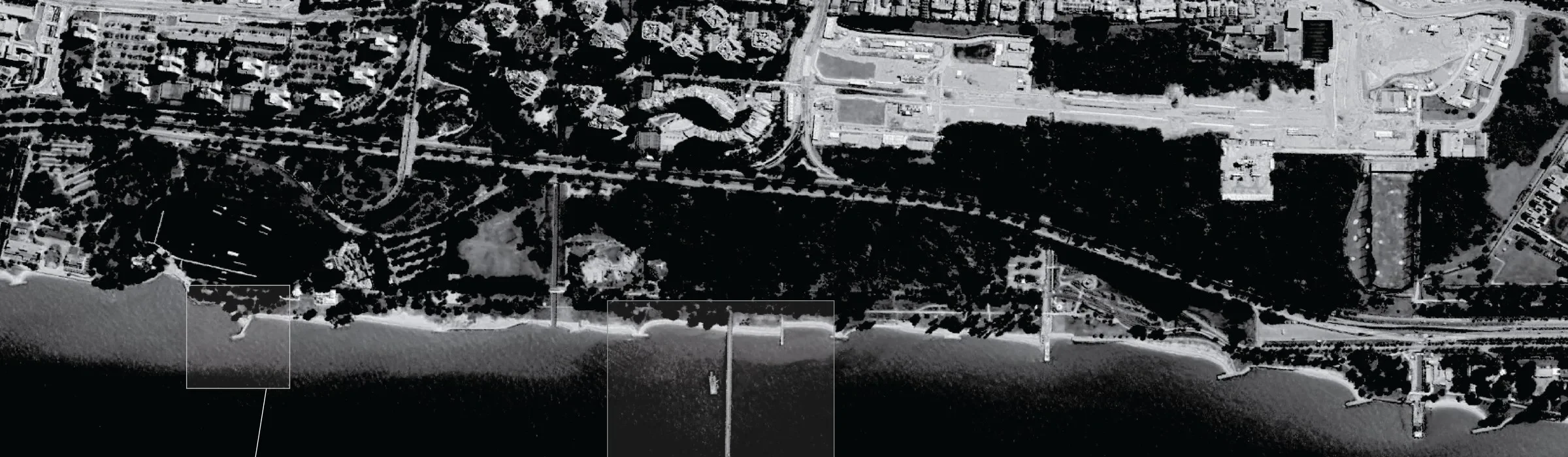
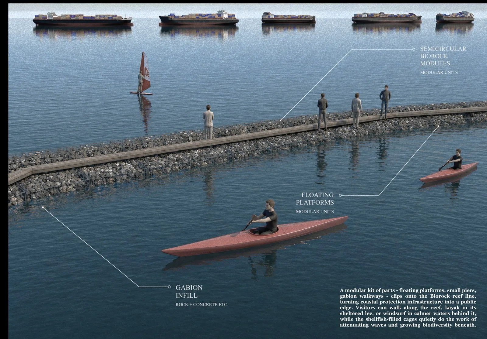
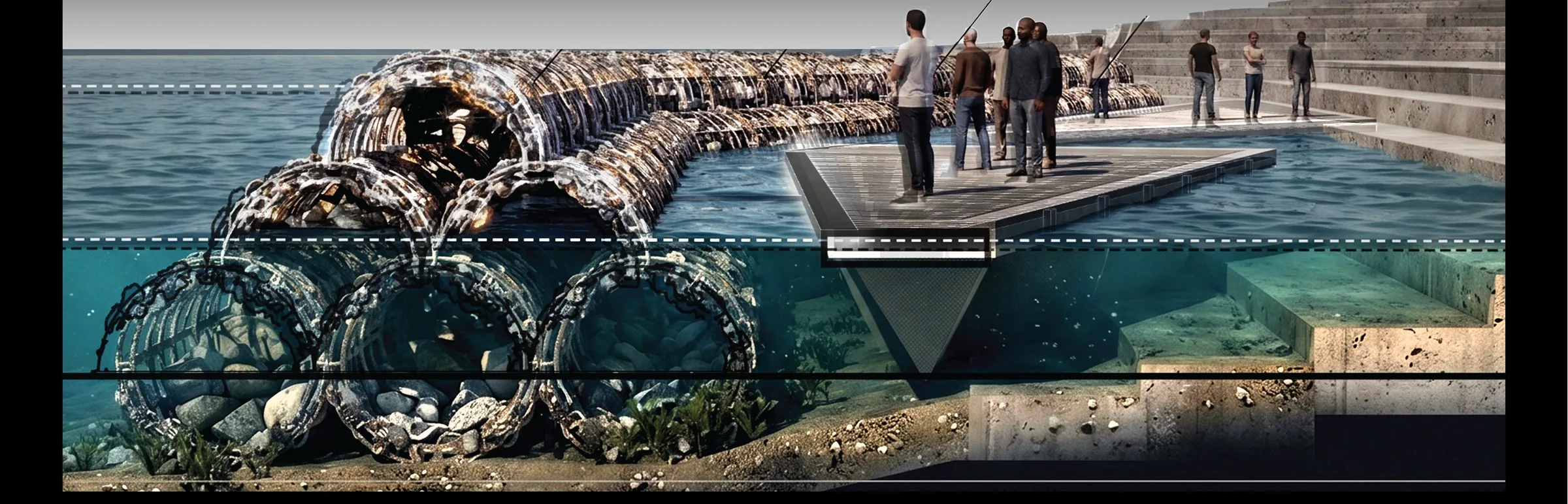
Set in the intertidal zone, the modules are submerged at high tide and surface at low, forming a living breakwater along the shore. A kit of parts — floating platforms, small piers, floating gardens — can be clipped onto the reef, so that the same structure that shelters the coast also becomes somewhere to sit, swim, paddle and look.
Shellforce — The Community Layer
The reef cannot be built without shells, and the shells come from the city. Shellforce is the community programme that feeds it: shells collected from restaurants, washed, laid out to dry in the sun until they are clean, then bagged and packed by many hands before they are carried out to sea.
This is a design decision, not an afterthought. Because the reef is made from simple materials and everyday waste, anyone can take part — in gathering shells, in building modules, in watching the reef come alive. It turns a piece of coastal infrastructure into something a neighbourhood helps make, and comes to own.
The Team
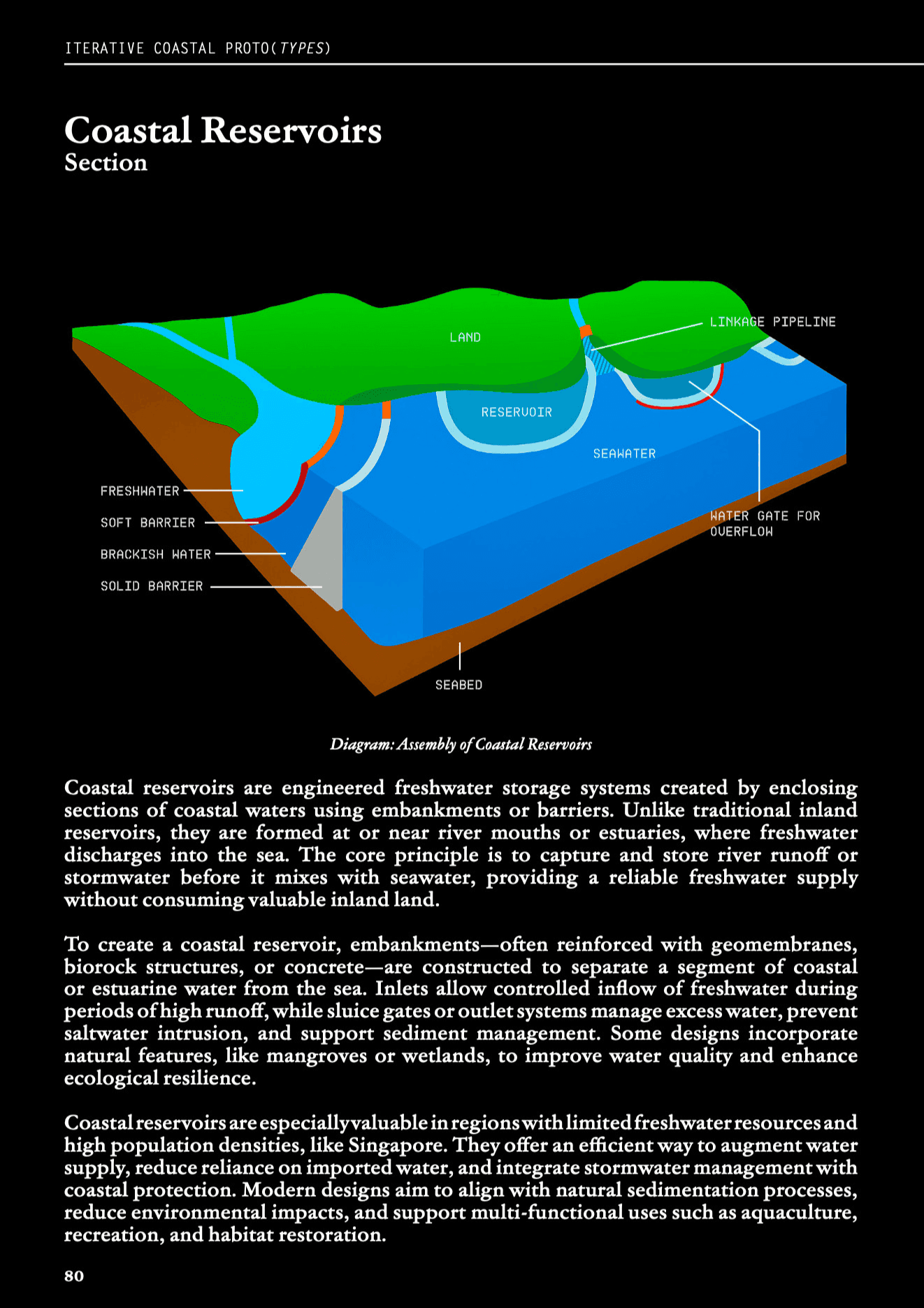
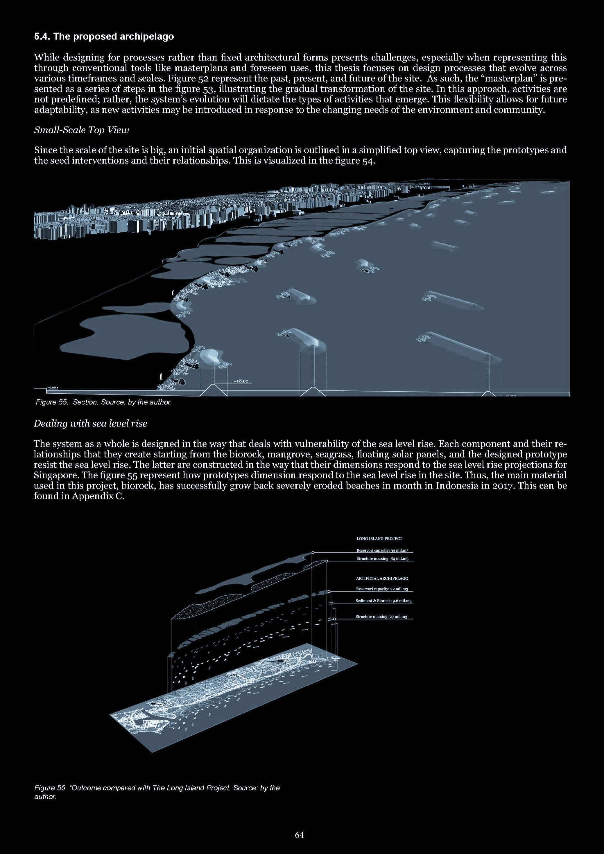
The Long Island Project involves the reclamation of land at higher levels off the East Coast and placing them in the form of "islands" located a distance away from the existing coastline. This project is aimed to help Singapore's effort in coastal protection. Another feature of the project includes the concept of a new reservoir. The reservoir will include two centralized tidal gates and pumping stations, similar to Marina Barrage, which will keep out seawater during high tides and discharge stormwater into the sea during heavy rainfall. The tidal gates and the reclaimed land will form a continuous line of defense along the coast for protection against rising sea levels.
Presently, the Long Island Project remains conceptual and feasibility studies kicked off in 2024.
To explore the evolution of Singapore's coastline beyond that in the initial Long Island proposal, cumulative research beyond the boundaries of the Long Island Project scheme, driven by research by design alluded to the proposal of 3 possible design schemes as alternatives.
Scheme 1 : Archipelagic Ecologies
Singapore University of Technology and Design (SUTD)
In collaboration with: Adelin Johari | Darius Chen | Brayden Tang | Nicholas Lim | Daryl Ho
Advisors : Eva Castro
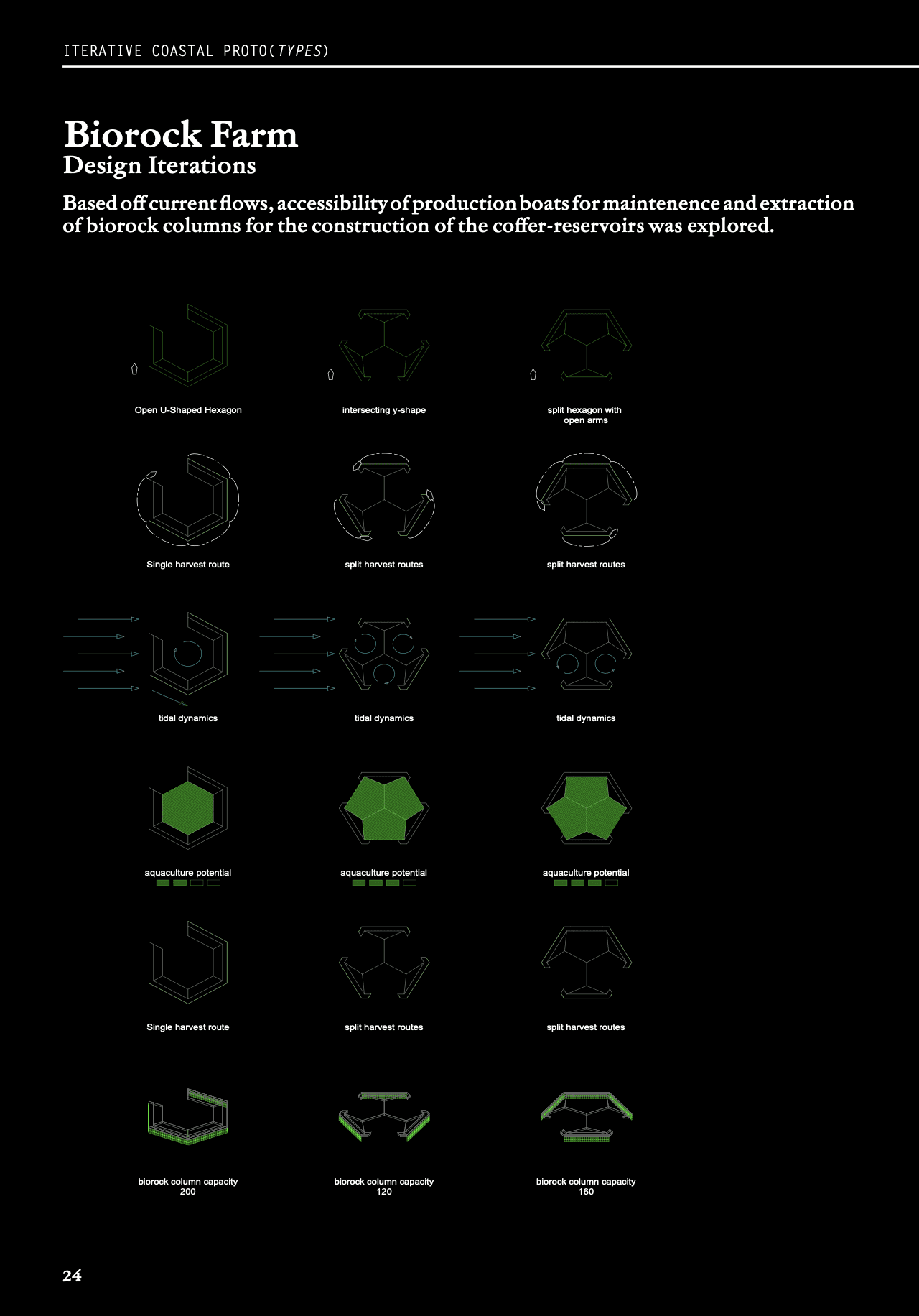
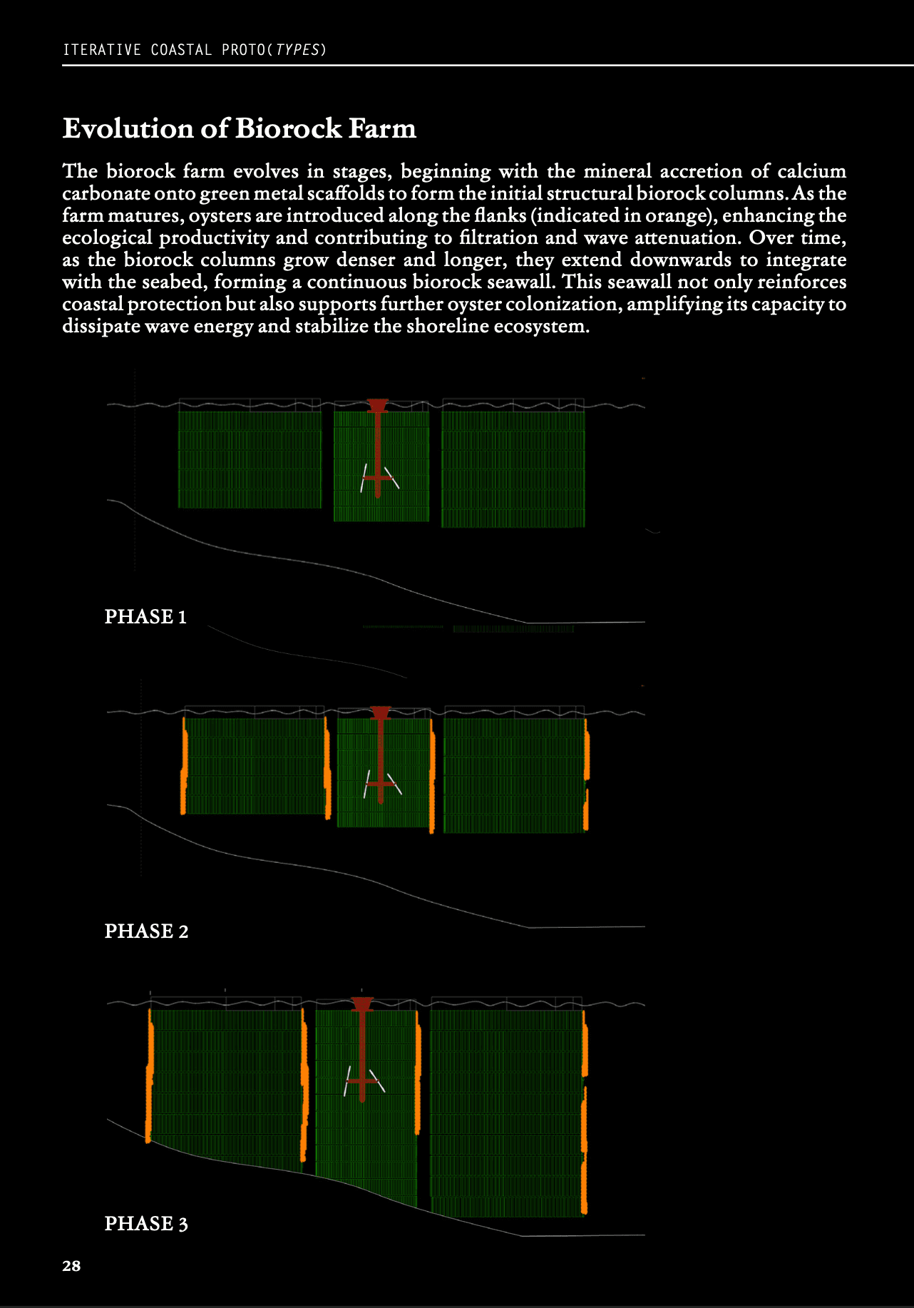
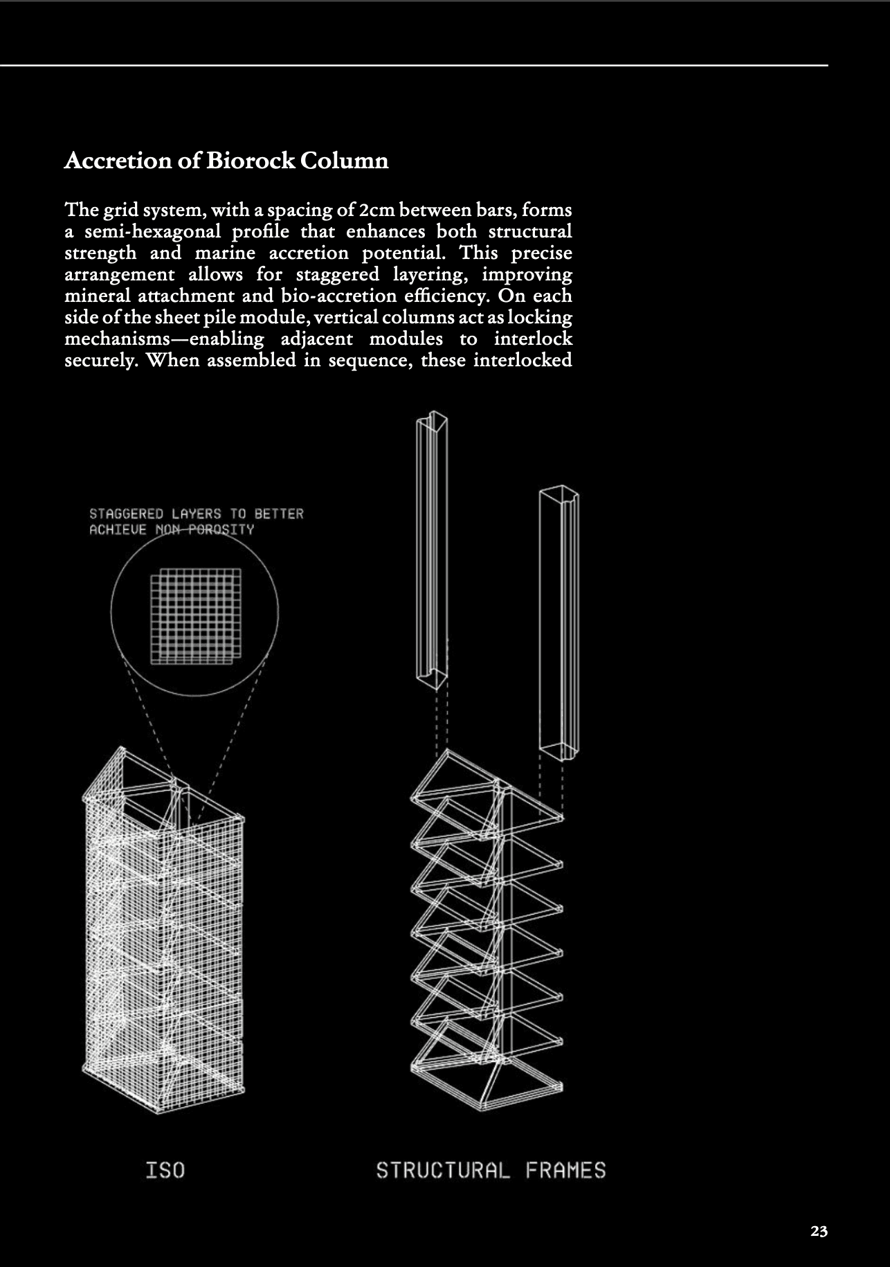
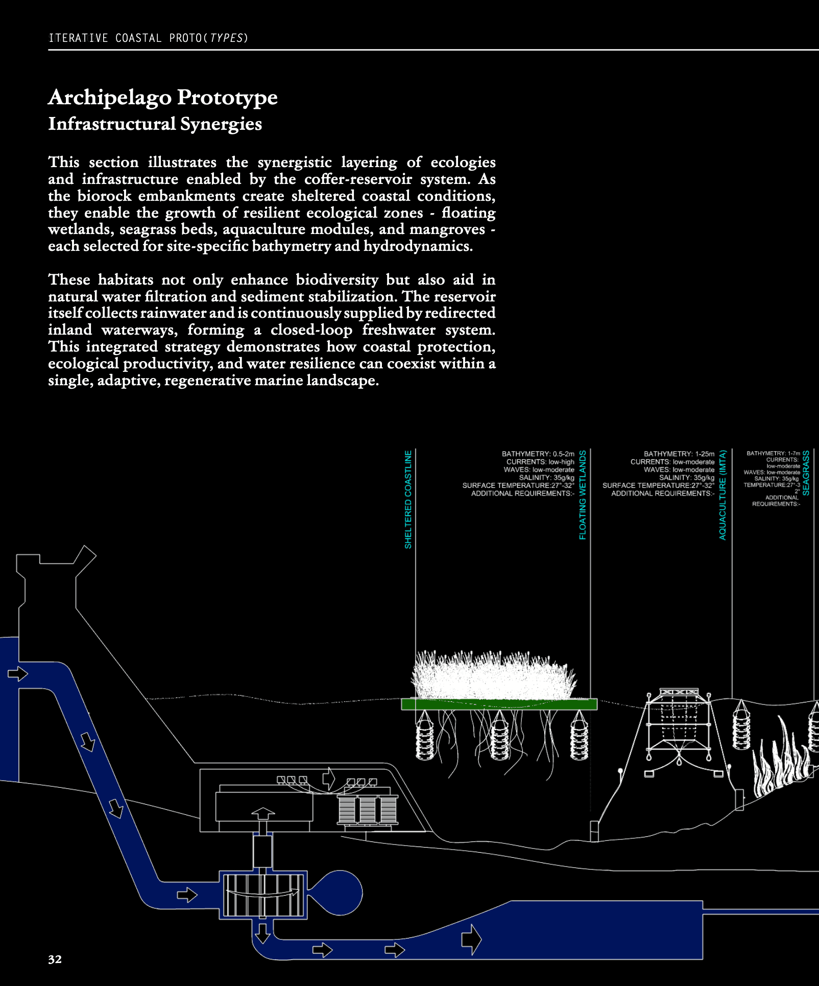
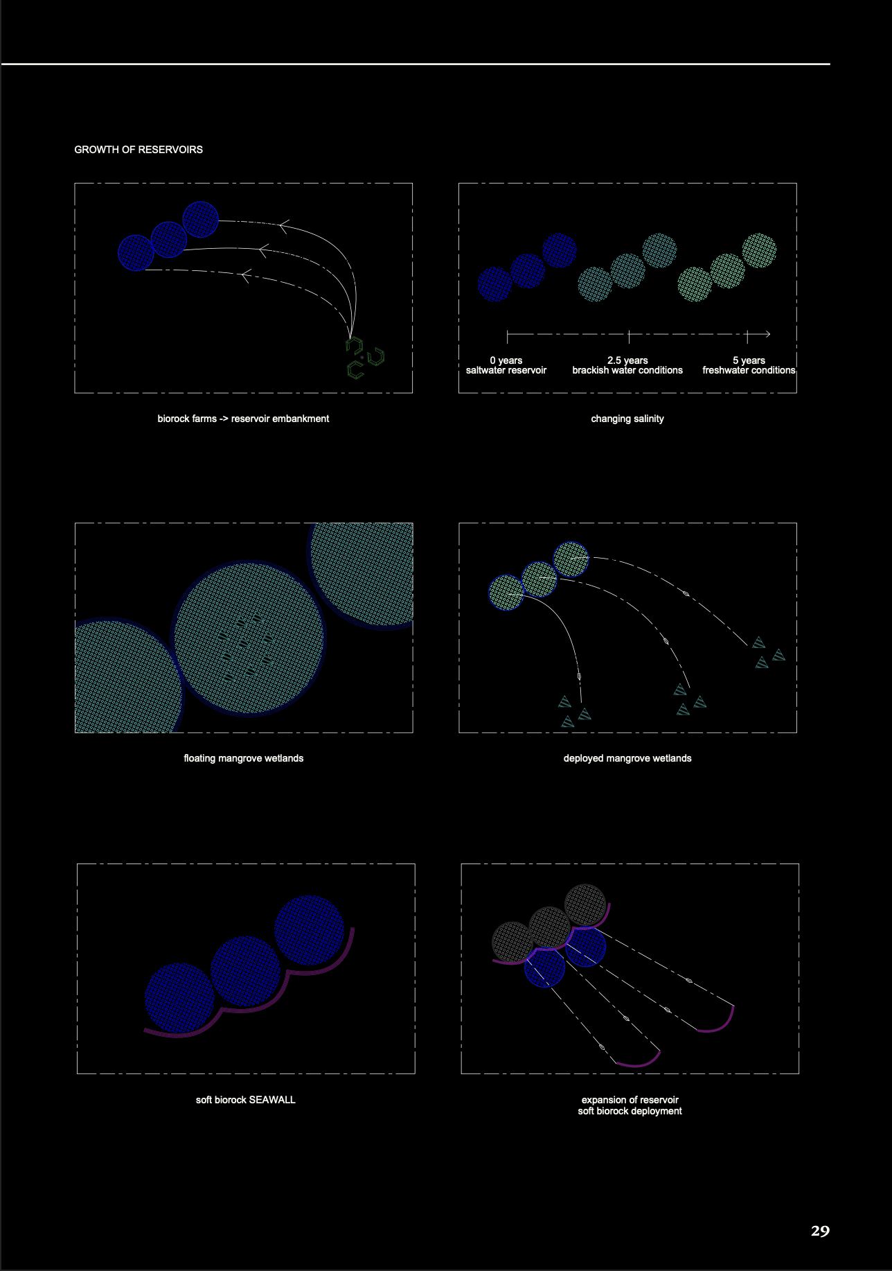
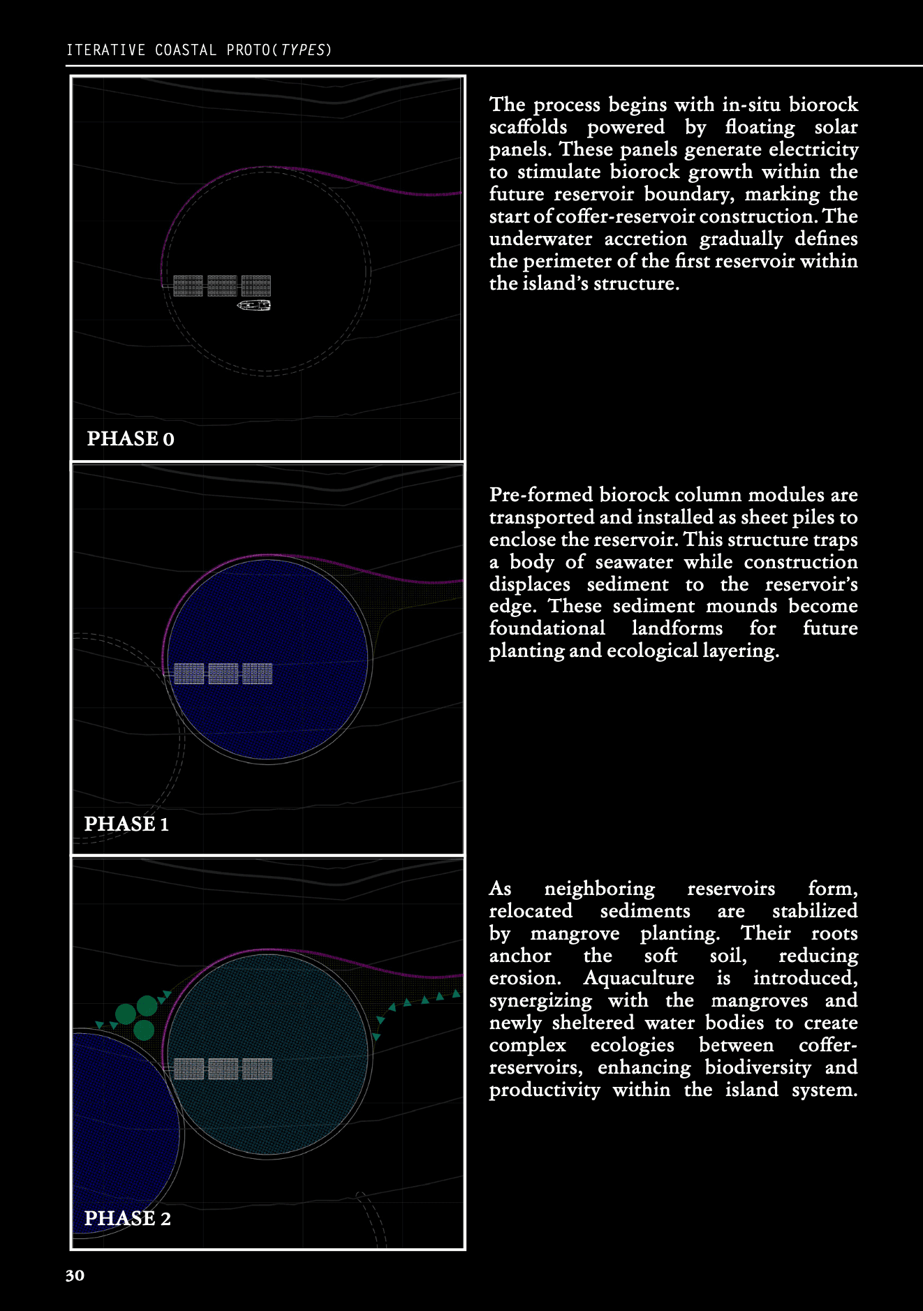
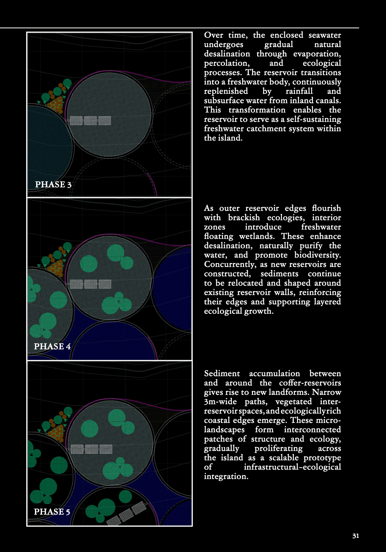
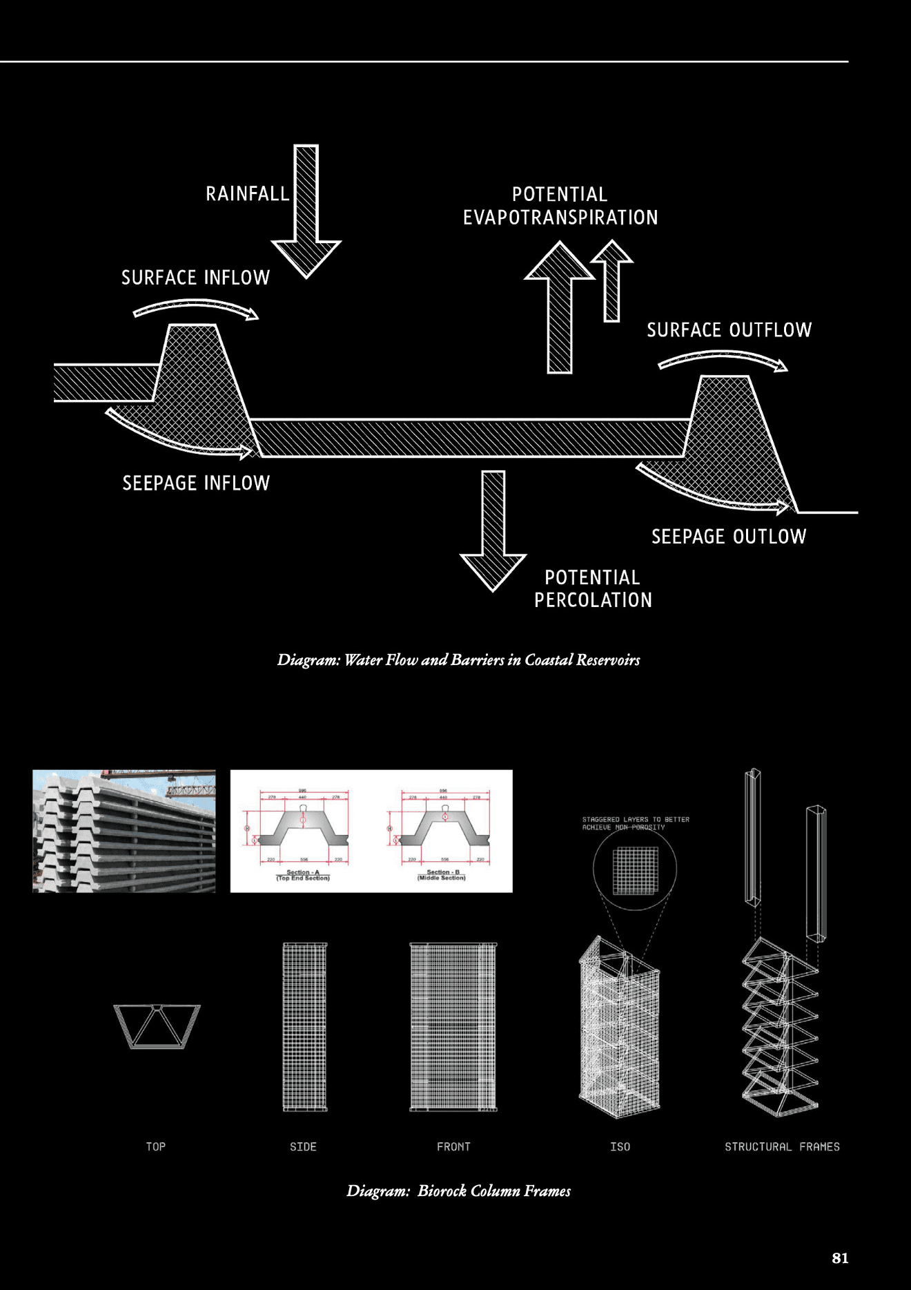
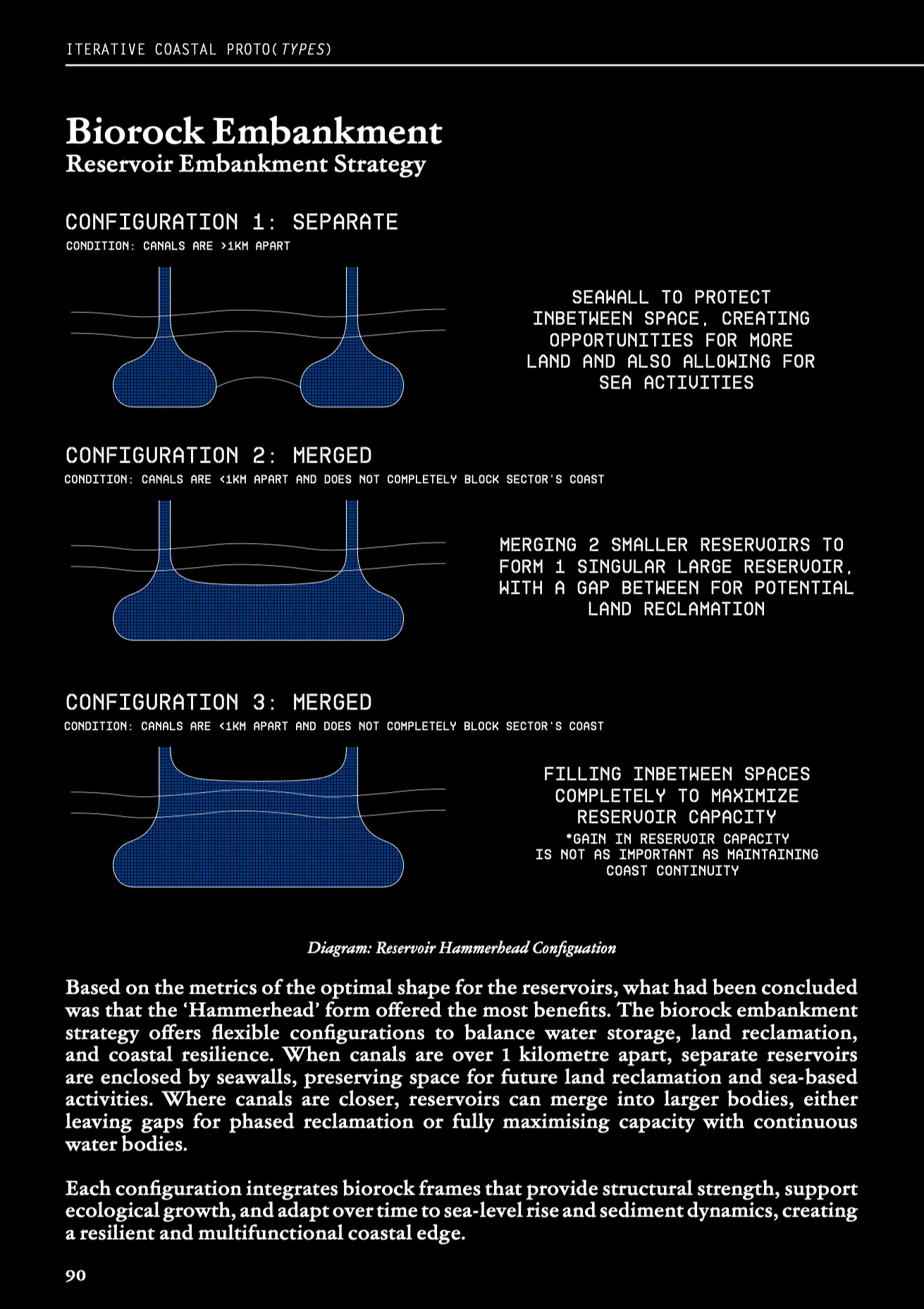
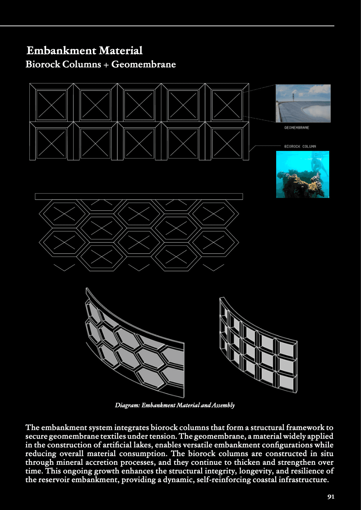
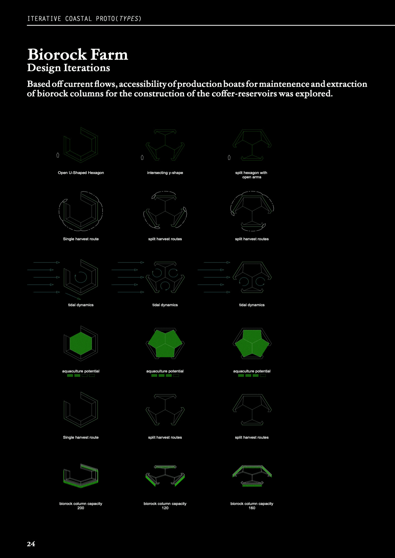
This scheme proposes a dynamic, self-sustaining coastal protection and water-harvesting infrastructure through an evolving archipelagic system. Initiated by offshore biorock farms placed in high-current, deep-sea zones, tidal energy is harvested to stimulate rapid mineral accretion, producing structural biorock components. These are then transported inland to construct modular biorock embankment walls that enclose coffer-reservoirs — artificial islands designed for natural desalination, transforming seawater into usable freshwater over time. As islands multiply outward in layers, they function collectively as wave dissipators and ecological buffers. Interconnected seawalls and tidal gates form a flexible defense spine, designed to accrete vertically in tandem with rising sea levels. The perpetual seeding of biorock, aquaculture, and vegetation transforms the system into a machinic landscape — generating surplus water, food, and construction material for replicable deployment elsewhere. Blurring boundaries between infrastructure and ecology, this territorial strategy redefines coastal resilience as a living, growing, adaptive system rather than a static barrier.

Scheme 2 : Generative Coastlines
Singapore University of Technology and Design (SUTD)
In collaboration with: Darius Chen | Adelin Johari | Brayden Tang | Nicholas Lim | Daryl Ho
Advisors : Eva Castro
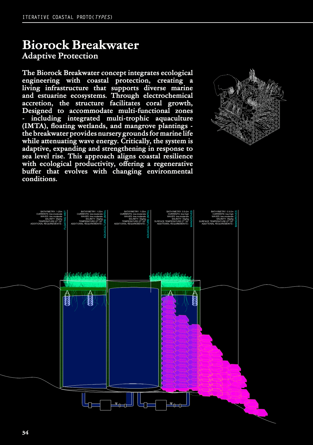
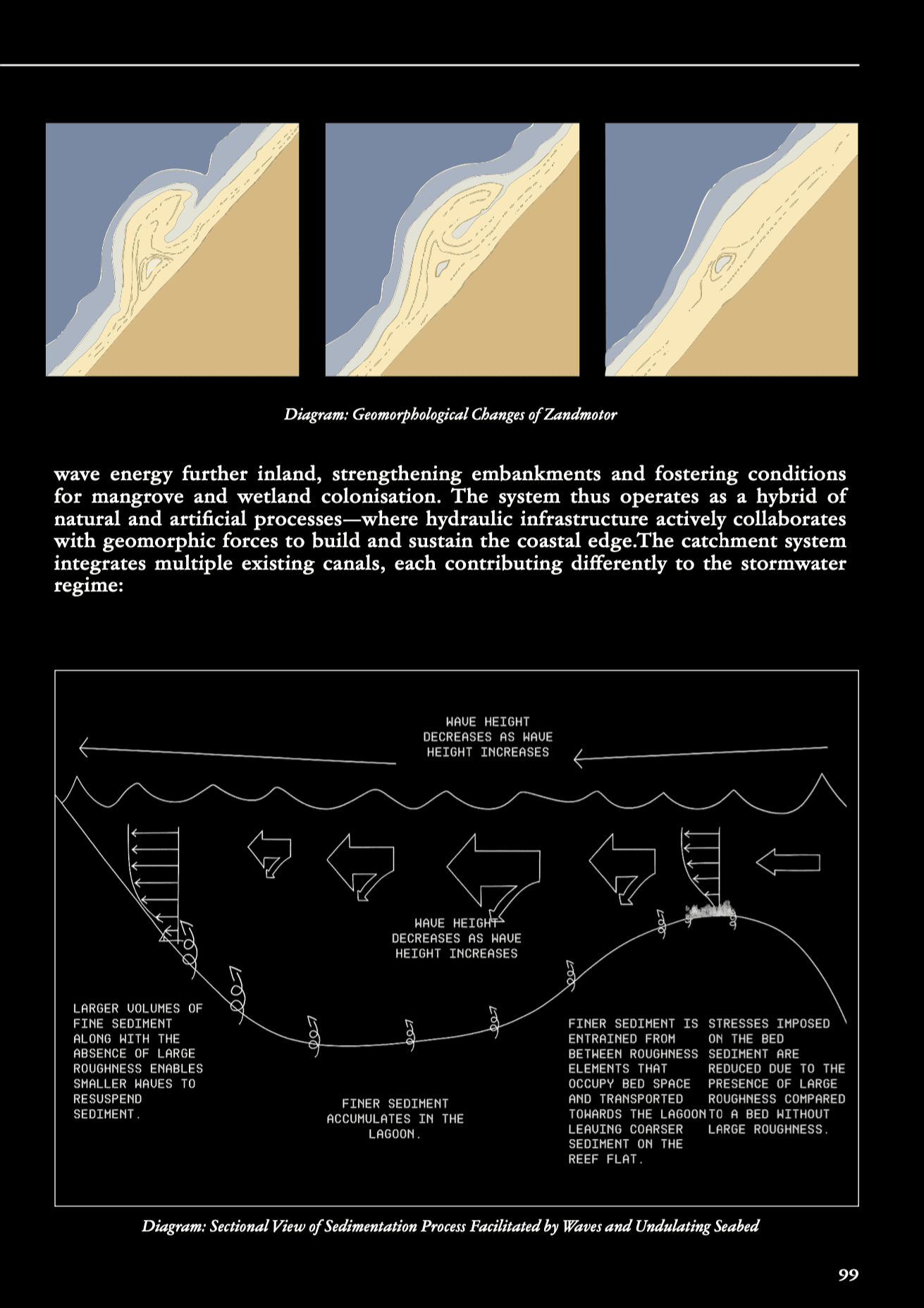
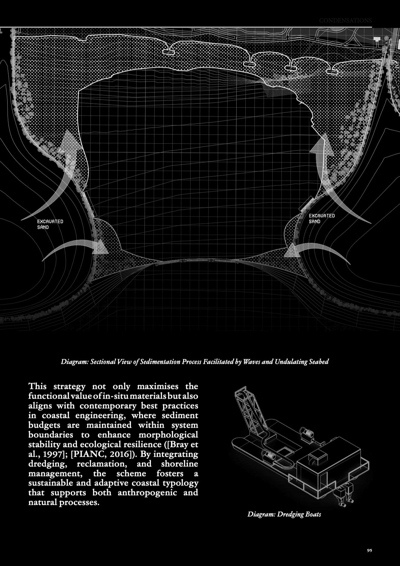
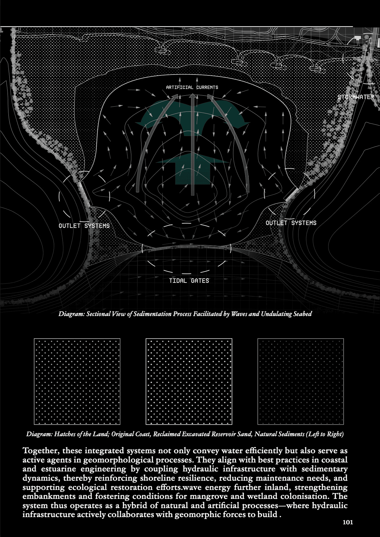
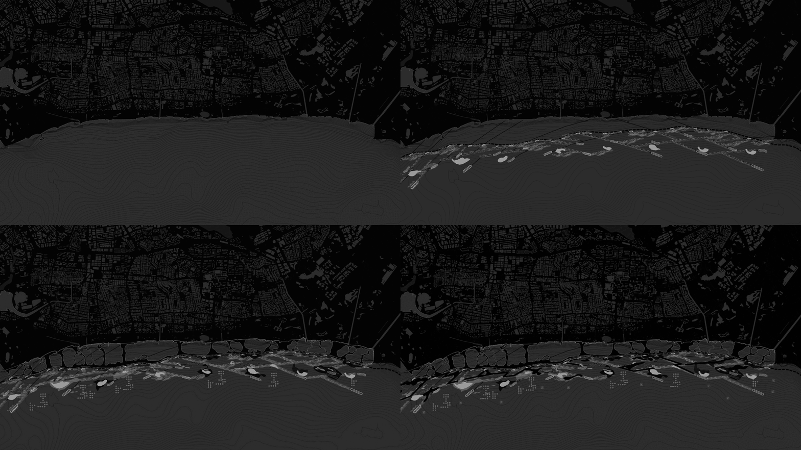
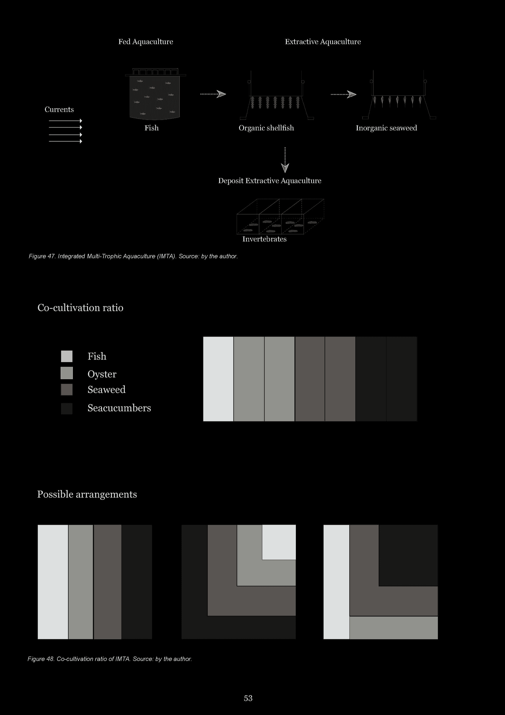
Scheme 2 builds upon and adapts components explored and prototyped in earlier schemes, such as biorock columns, artificial reservoirs, and sediment transport systems. However, it differs through its closer relationship to the existing coast, engaging directly with the coastline's form, identity, and ecological character. Rather than operating at a detached or territorial scale, this scheme seeks to extend the coast where appropriate, carve into selected areas, and most importantly, enrich, protect, and sustain the coastal edge. It combines natural processes like sediment accretion, tidal flow, and ecological succession with essential infrastructural interventions, blending softer ecological strategies with necessary grey infrastructure. The approach reduces reliance on extractive resources by reusing excavated materials for land formation, repurposing functional spaces, and creating multi-layered systems that address hydrological performance, ecological restoration, and public use. Reservoirs, biorock breakwaters, and managed sediment beaches work together to protect the coast against sea-level rise while supporting habitat creation, recreational uses, and productive aquaculture. This summary sets the stage for the project's introduction, presenting a vision of an adaptive and resilient shoreline that integrates natural and infrastructural systems to safeguard and enhance the coastal landscape.

Scheme 3 : Reveries of a Moving Edge
Singapore University of Technology and Design (SUTD)
In collaboration with: Daniel Gradwohl
Advisors : Tina Cerpnjak, Eva Castro, Pia Fricker
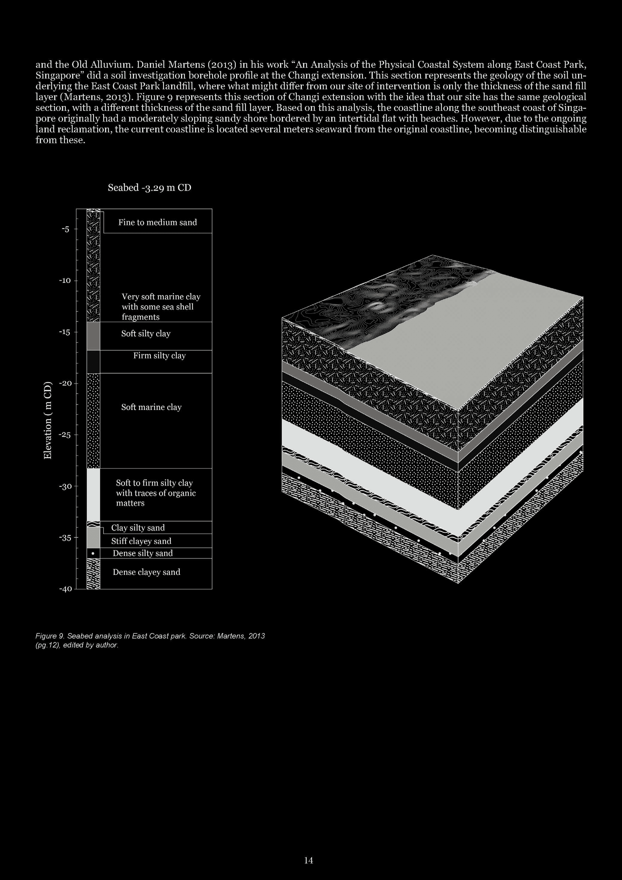
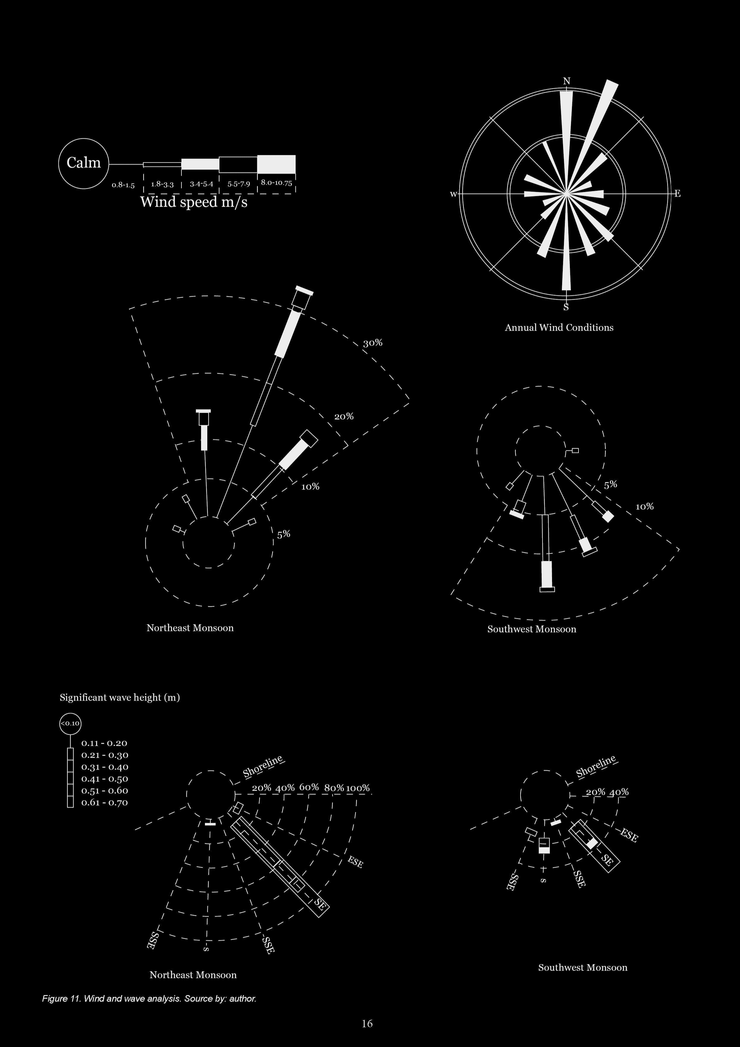
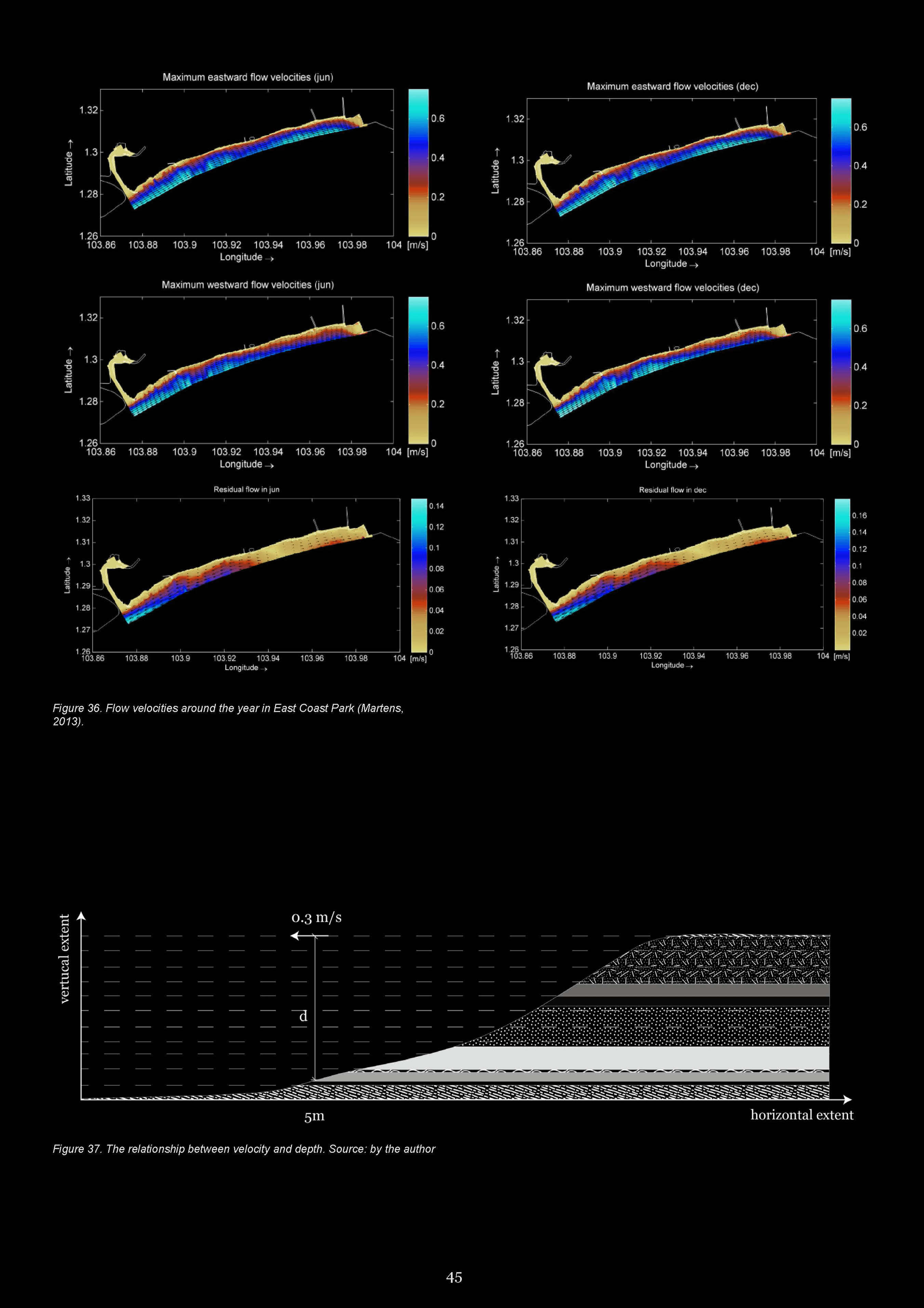
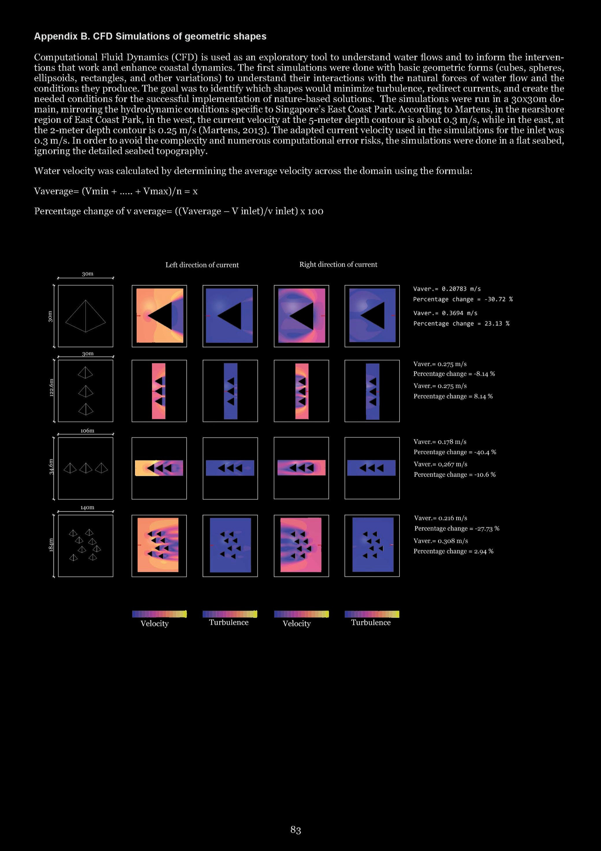
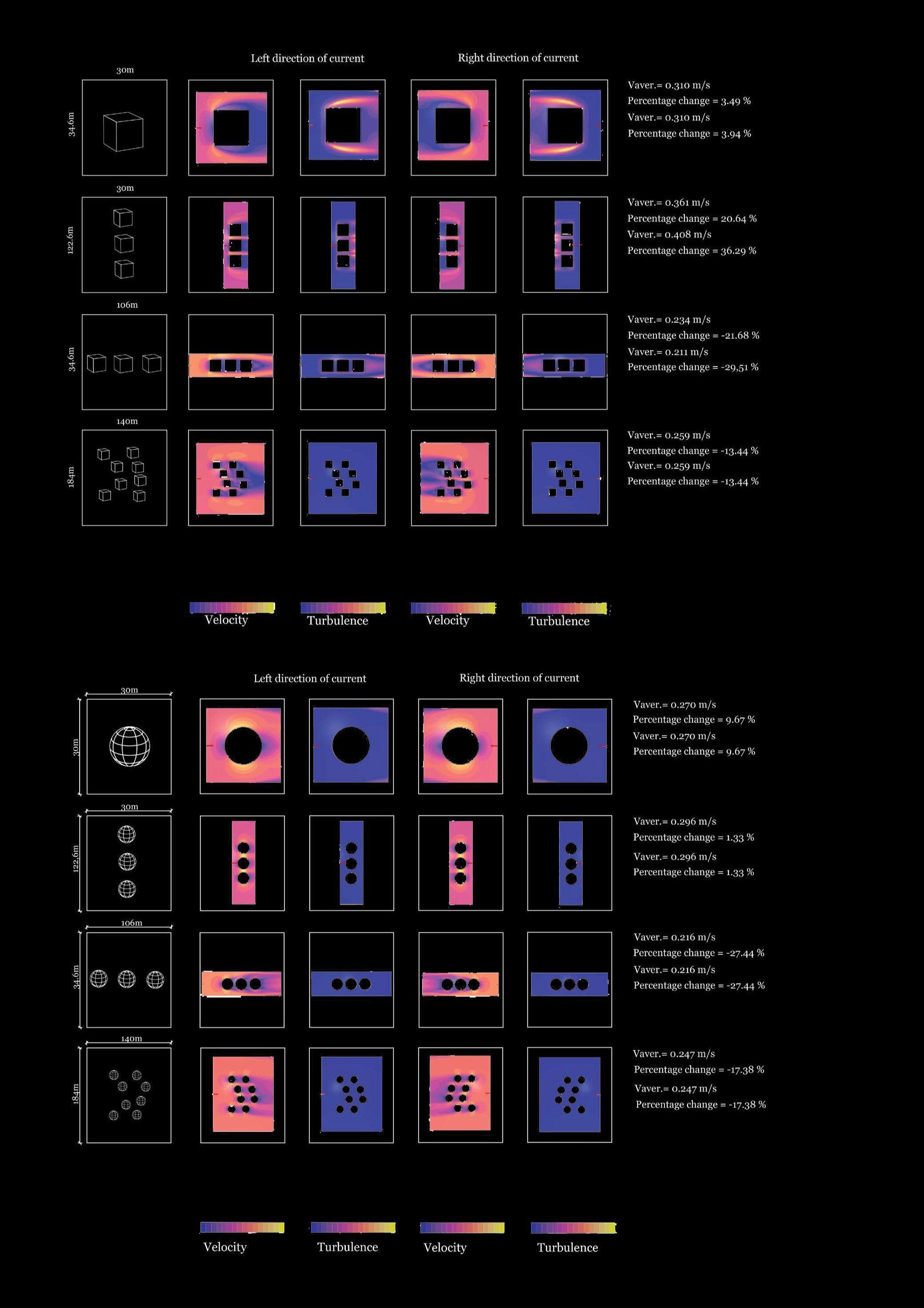
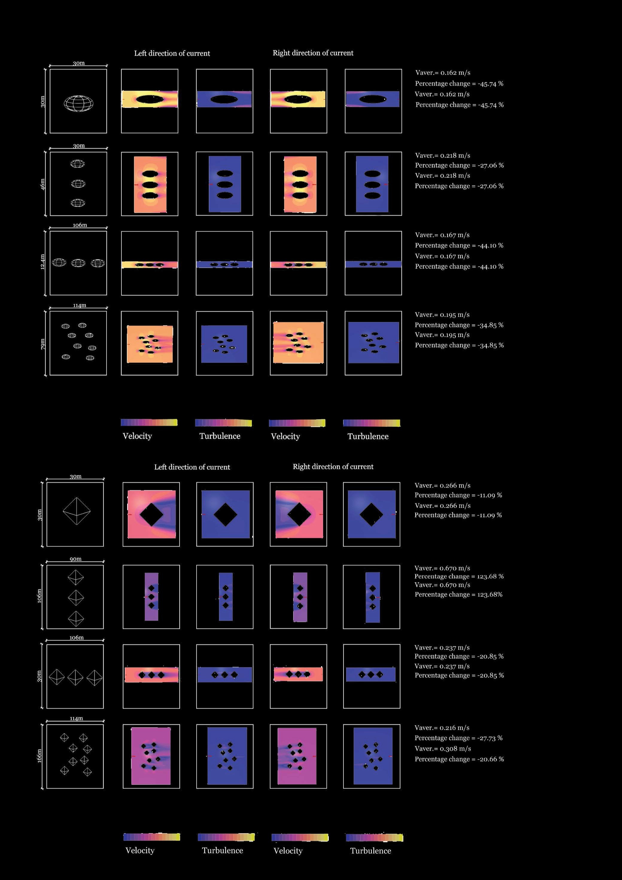
Scheme 3 is rooted in practical, multidisciplinary onsite workshops in Singapore. Collaboration between local stakeholders such as Singapore's National Water Agency (PUB) and other expert firms from around the world with a base in Singapore, including hydrologists and engineers, enriched the design process. Their local knowledge and expertise helped ground the speculative design in the realities of the site, ensuring that the proposed visions are informed by both local insights and technical methodologies. Building on this collaborative approach, the historical development of Singapore's coastline through land reclamation, along with future projects such as the Long Island project, epitomized the dynamic and contested nature of the marine environment. To respond to the dynamics of shifting boundaries, this thesis investigates a holistic approach that co-designs with natural processes, fostering a collaborative process between humans and non-humans. Inspired by Latour's concept of the Middle Kingdom, which transcends borders between nature and culture, the study incorporates computational design methodologies such as Grasshopper and computational fluid dynamics (CFD). Simulations of water movement and the process of form-finding that would best support nature-based solutions were conducted, focusing on dynamic adaptability and considering not just current needs but also future scenarios where time and change are continuous. By adopting a transdisciplinary approach that synthesizes systems thinking and actor-network theory, the study captures the complexity of the coastline as a web of interactions between natural and cultural forces, emphasizing process over permanence. The proposed coastlines challenge traditional notions of fixed boundaries between nature and culture, offering a holistic, adaptable approach and opening novel ways of architectural thinking in design strategies for ever-shifting coastline territories in the face of climate change.
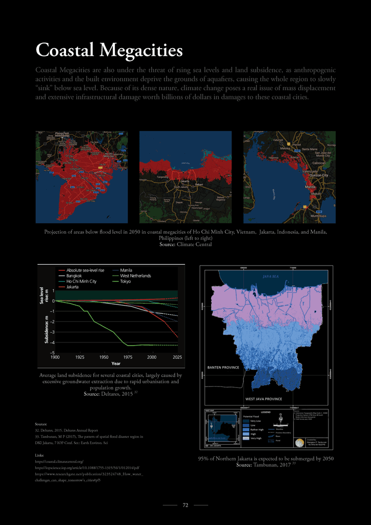
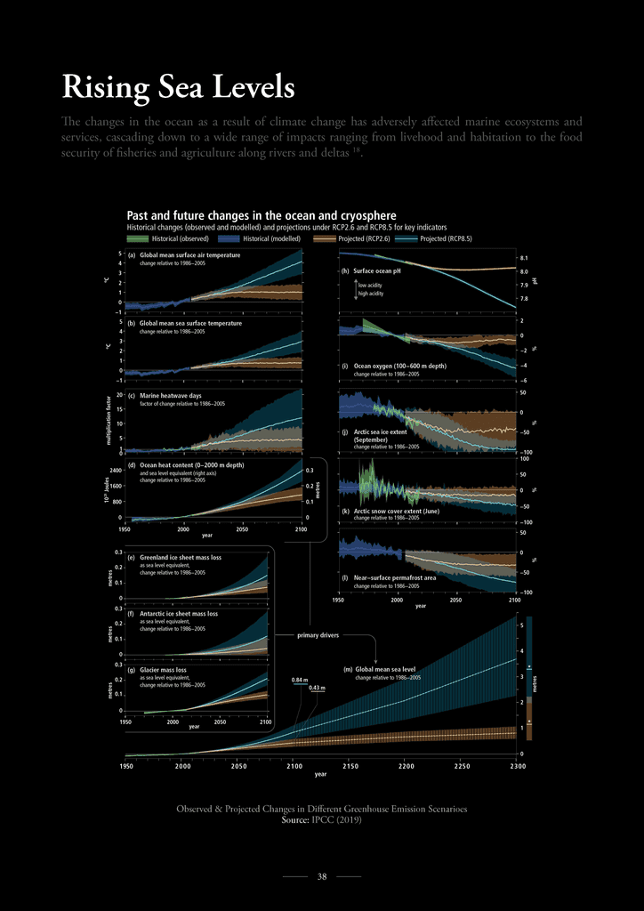
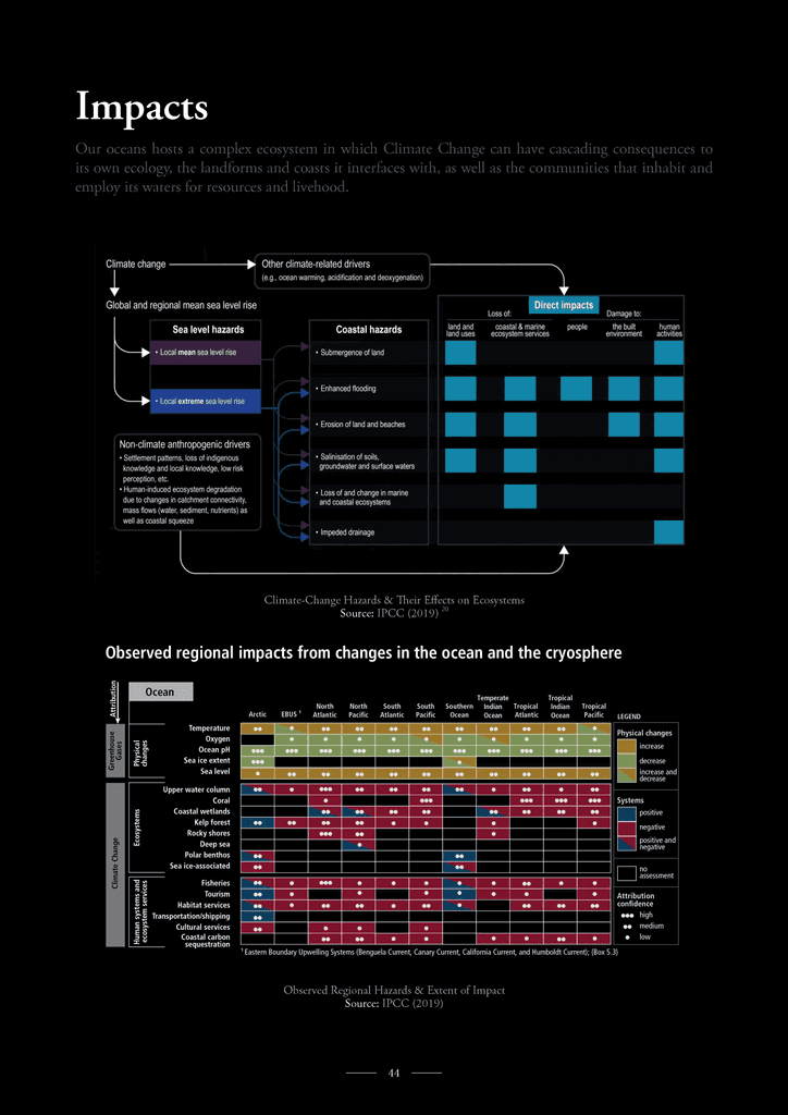
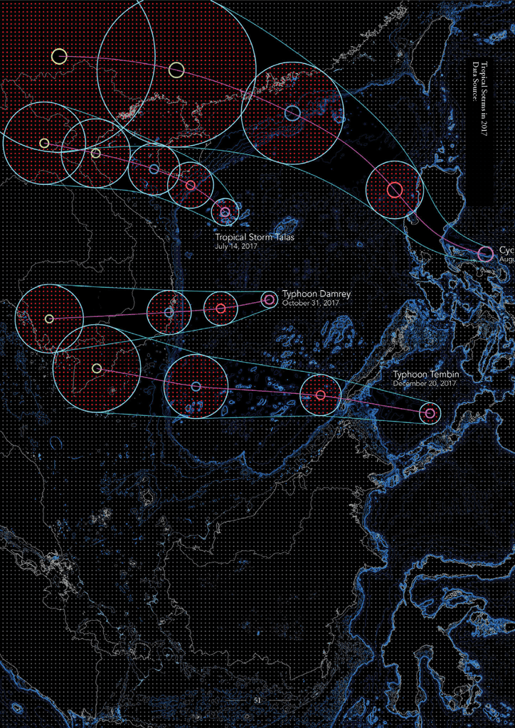
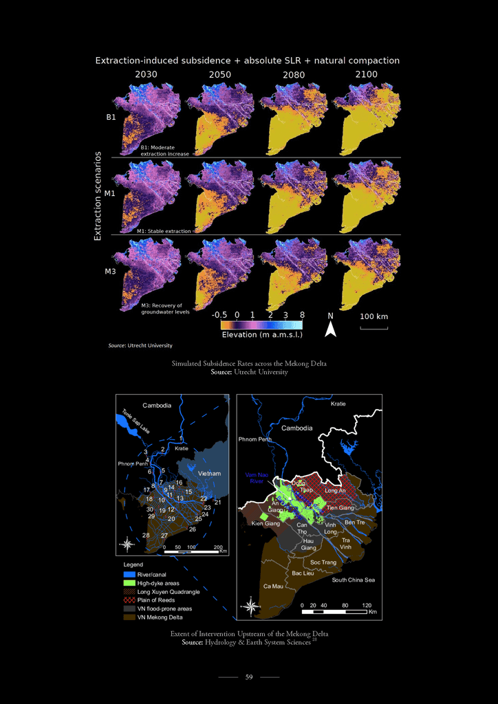
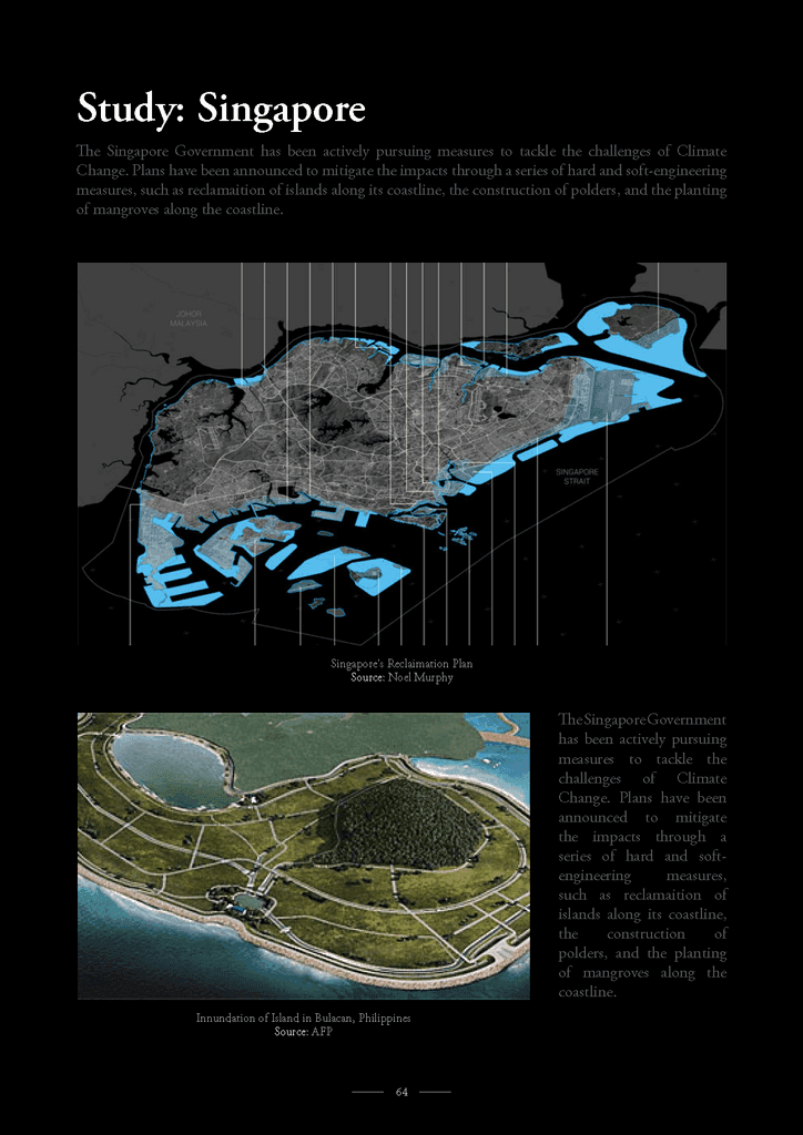
This territorial research challenges outdated and mono-tonic, mono-functional modes of reading and (re-)designing the territory.
The project explores new forms of inhabitation and of production, new synthetic ecologies able to propose multi-layered, complex and highly densified habitats within coastal areas. Within it, infrastructure is understood as the means to engage with the machinic processes ranged across the territory. The critical role played by infrastructure in the organisation and management of the city's complex systems of movement, communication and exchange is recognised as the basis from which its operation can be further developed and pushed beyond its tendency to fragment and divide toward other possibilities. We pursue the formal and material articulation of infrastructure, coordinating its operations with the territorial processes, forms and parameters identified in the site, developing its relation to the ground.
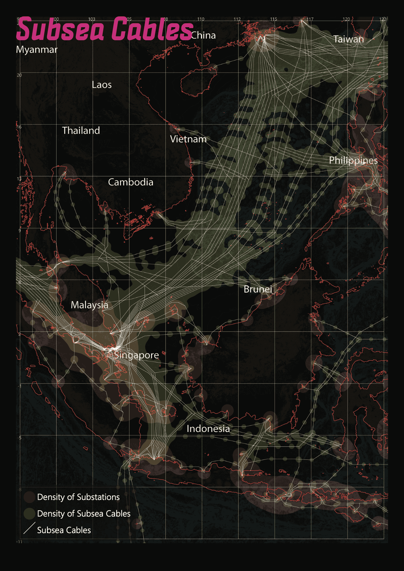
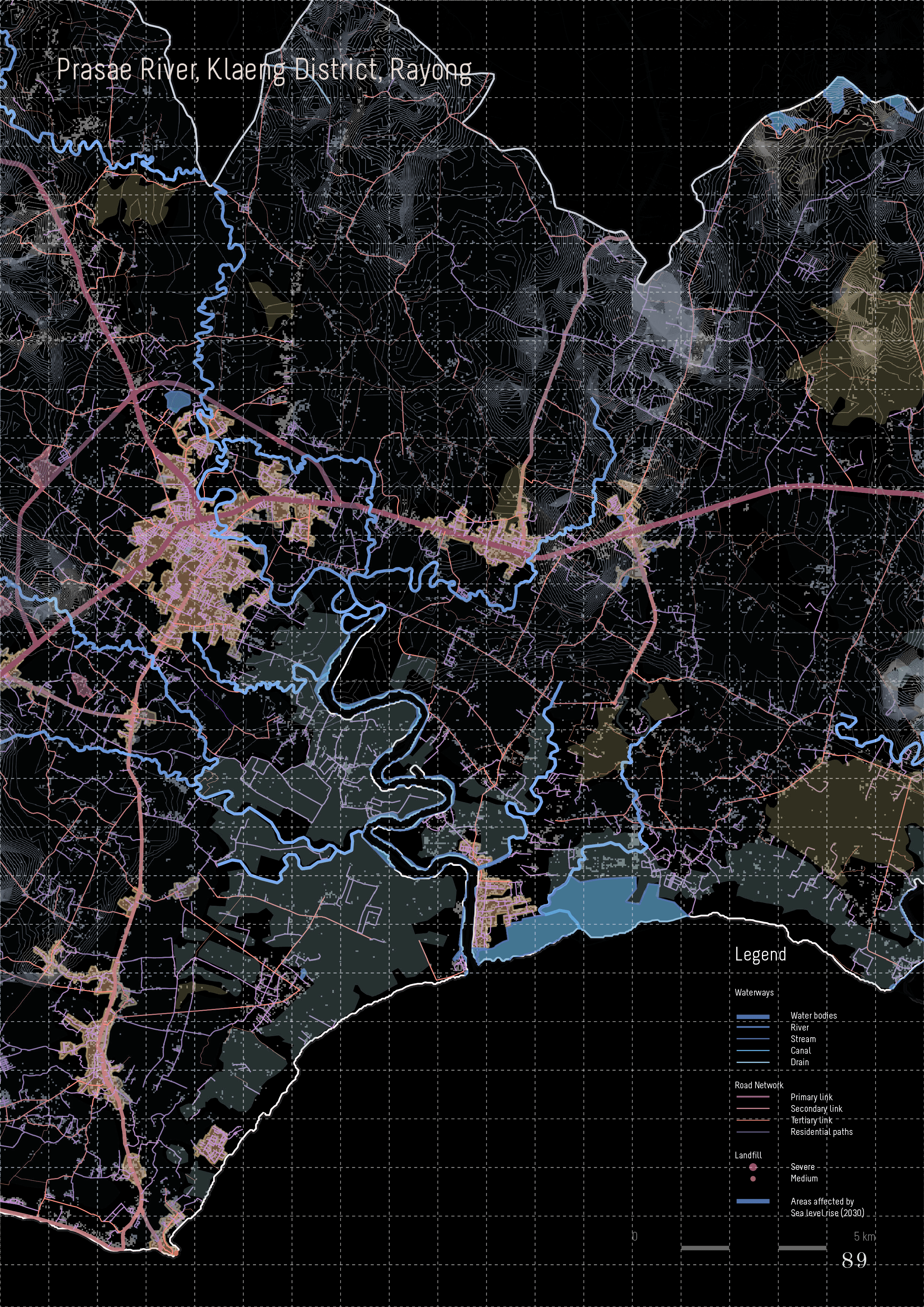
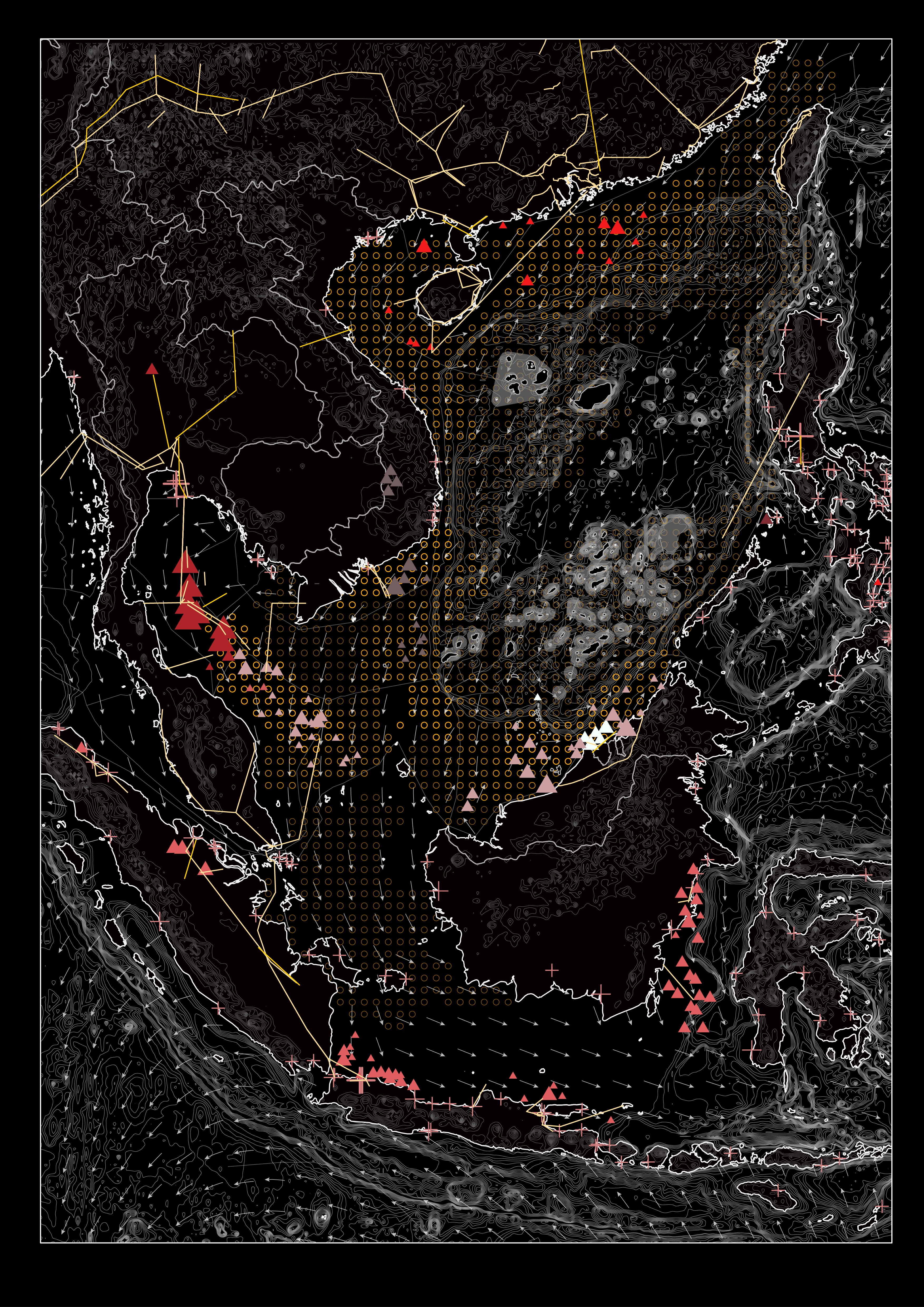
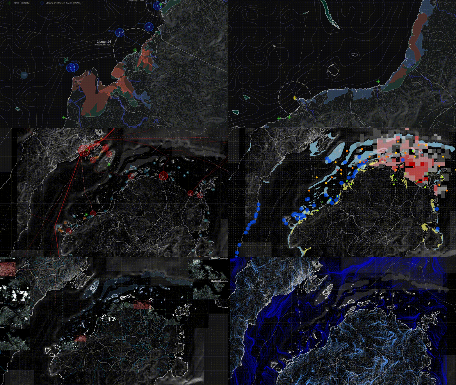
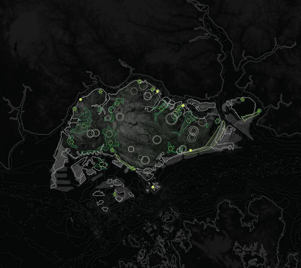
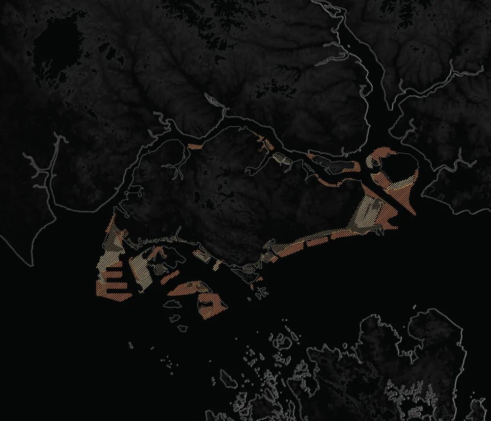
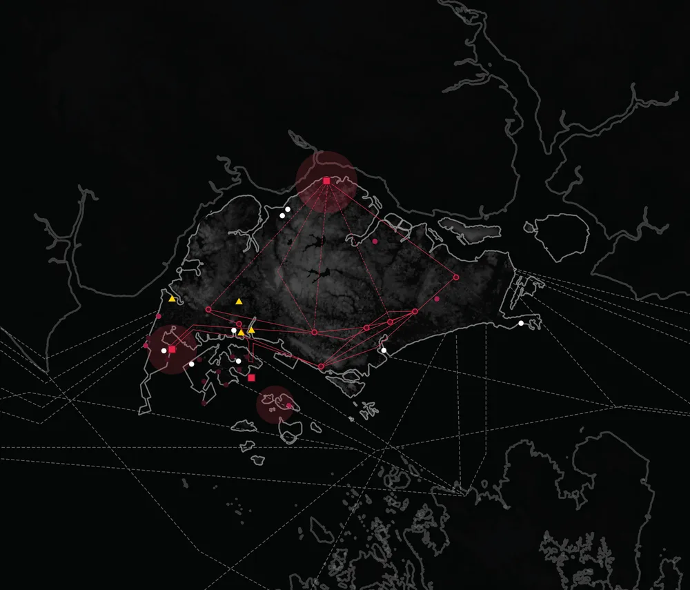
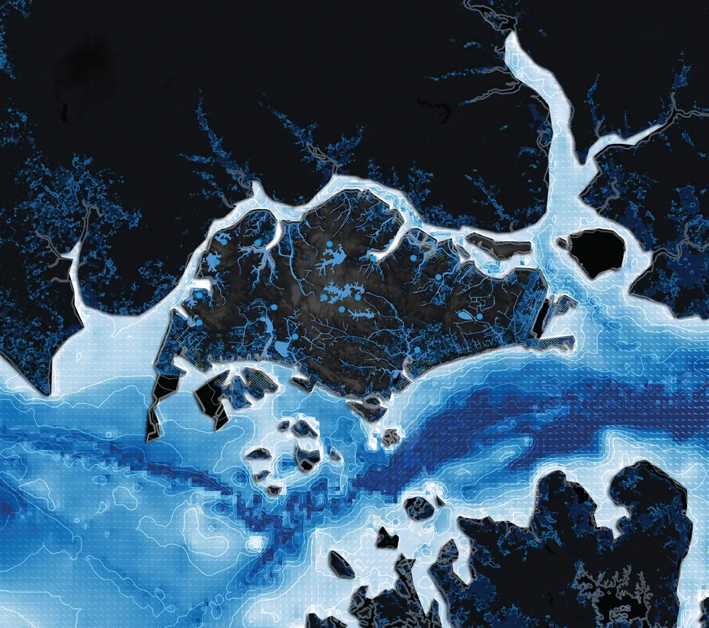
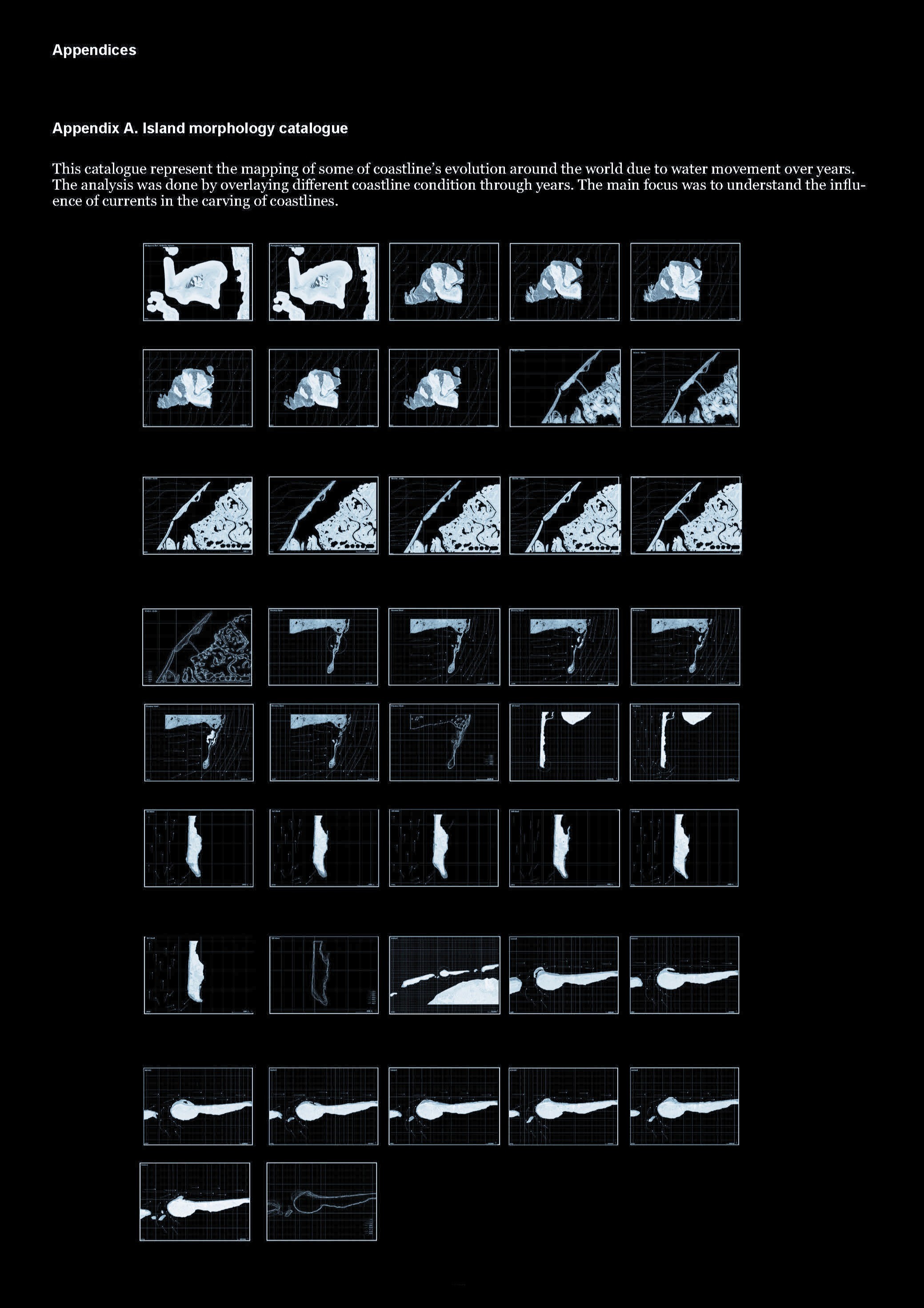
This is part of our ongoing research to generate a South-East Asia Atlas that connects anthropogenic action with climate change and sea level rise within the region's coastal areas. It operates as a guide through issues found and problematised through a cartographic system.
This body of research grows and transforms along time as new parameters are incorporated both in the general climatic/political condition of the world and within our own local palette of academic interests within South East Asia.